

Remote Sensing Solutions
Shed light on your Areas of Interest (AOI) with traditional RBG, 4-Band, and/or LiDAR services.
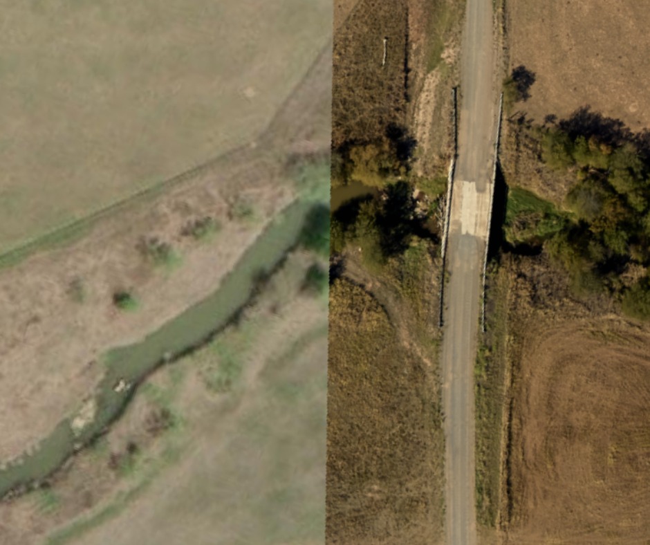
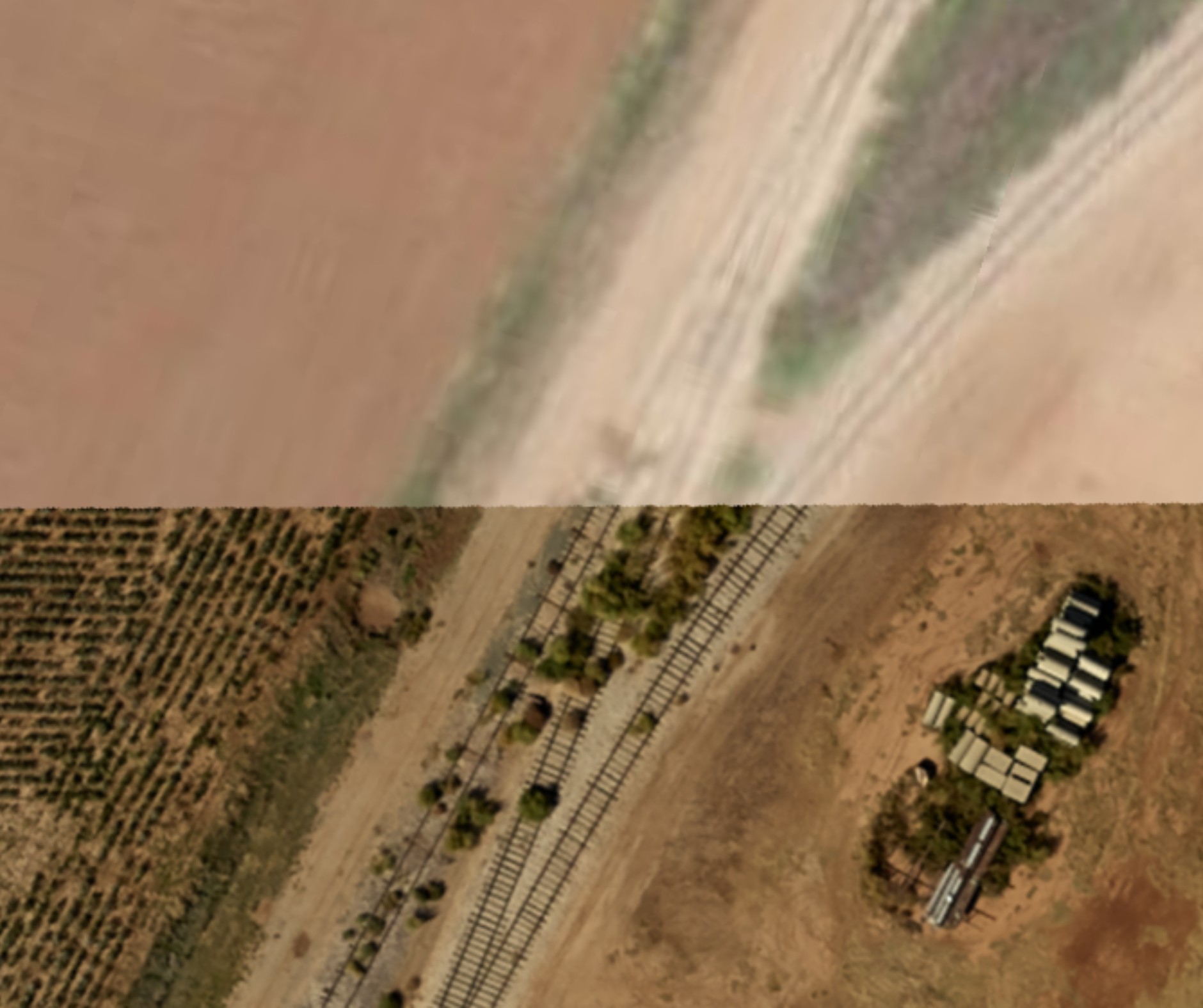
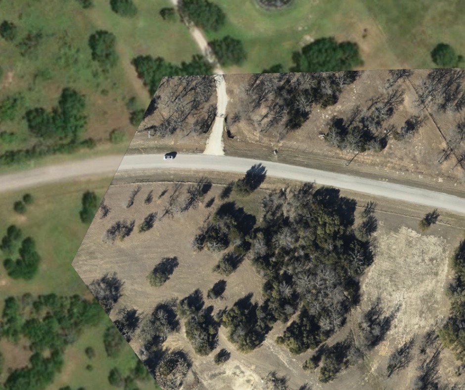
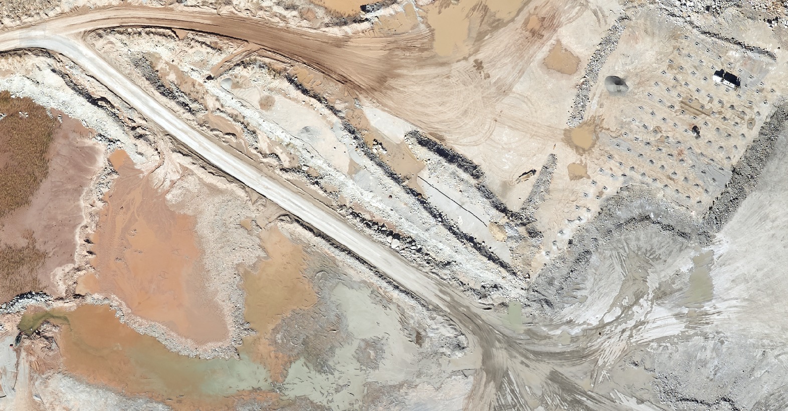
Aerial Data & Analytics
Make data-driven decisions that can lead to more efficient operations and increased profitability.
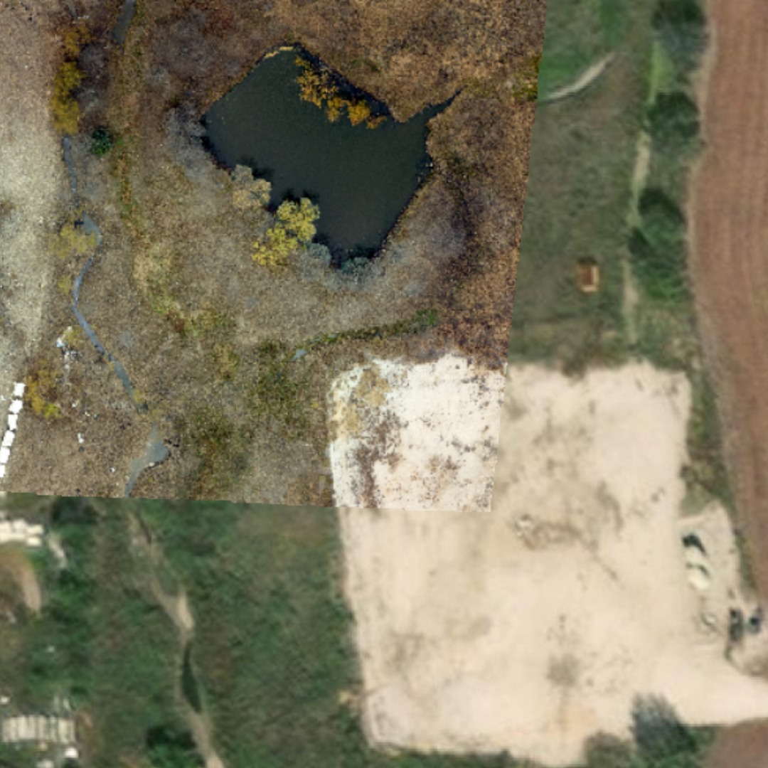
Digital Elevation Data
Understand terrain-related issues, including elevation, slope, watershed, and runoff patterns for better project planning.
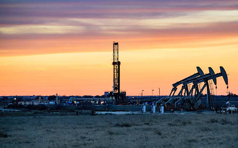
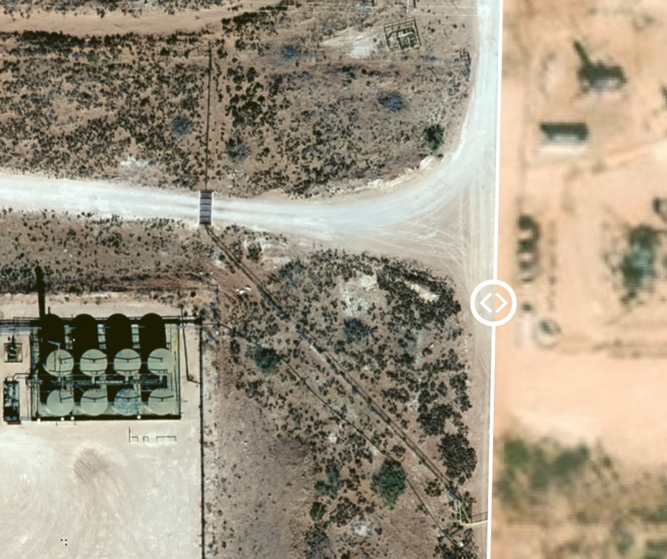
Texas GIS O&G Mapping
Assess potential pad locations, better configure operations workflow, manage pipeline compliance requirements, and more.
Empowering Government & Industries Throughout Texas
Texas is a state known for its robust economy, driven by major industries such as oil and gas, healthcare, technology, and agriculture. According to the Bureau of Economic Analysis, Texas had a GDP of $1.8 trillion in 2020, with the oil and gas industry alone contributing $200 billion. With such a strong economy, it is essential to use technology to make informed decisions that can help sustain and drive growth for Texas-based companies.
This is where Prius Intelli comes in. Our Geographic Information System (GIS) services and solutions are helping Texas governments and industries increase operational efficiencies, better manage risk, and enjoy stronger profitability. We serve a wide range of industries including oil and gas upstream and midstream companies operating in – and moving hydrocarbons out of – oilfields across Texas and beyond.
Did you know? The Texas Railroad Commission (RRC) provides GIS data to oil and gas operators, industry analysts, and regulatory agencies. Texas RRC GIS data options include information on oil and gas wells, pipelines, and other related infrastructure. Our custom Texas GIS and aerial imagery solutions complement and expand upon available government sources, providing exclusive-to-you insight into your projects.

Texas GIS Services from a Texas-Based Company
From our headquarters in Fort Worth, Prius Intelli provides cutting-edge GIS and aerial imagery solutions that allow governments and businesses to make better decisions through accurate mapping, efficient data management, and real-time data analysis. Our proprietary sensor configurations produce high-quality data to meet most budgets, and our in-house GIS experts are on hand to help your company maximize your data’s value.
Our aerial photography services are available on demand, which means you get the data you need – exactly how and when you need it.
Schedule a call
Provide a few details on our “Get a Quote” page and schedule a call with our team.
We talk about your project.
Once we understand your project goals and objectives, we will tailor a solution and get you on the flight schedule.
Get to work. Fast.
Enjoy expertly crafted, on-demand GIS data and imagery, typically delivered within 2- to 4-weeks (weather dependent).


