


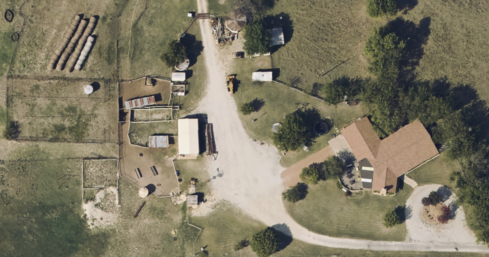
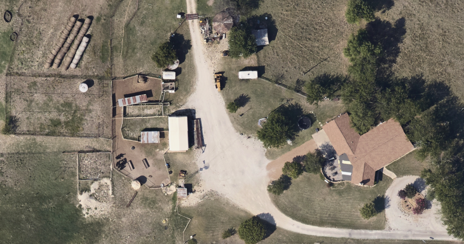
RGB ORTHOIMAGERY
Everyday Imagery by PI®
At Prius Intelli, we don’t just capture images – we create powerful visual tools that drive your projects and daily operations forward.
EVERY DEPARTMENT. EVERY DAY.
Empower Your Daily Decisions
Our Everyday Imagery by PI® combines cutting-edge RGB orthoimagery technology with unmatched expertise to deliver:
Game-Changing Clarity
Up to 10x better resolution than high-resolution satellite imagery to reveal crucial detail for informed daily decisions
Flexible Coverage
From less than one square mile to 1000+ square mile projects, adaptable to your daily needs
Rapid Deployment
Take-off timeline measured in days, not months, ensuring you always have up-to-date imagery
Geometric Precision
Distortion-free imagery for accurate measurements and planning across departments
Versatile Delivery
Access your data in multiple formats to suit the workflows of every department

30 cm Satellite
(12'' Horizontal — 20-40'' Vertical)

15 cm by Prius Intelli®
(18'' Horizontal)
10 cm by Prius Intelli®
(12'' Horizontal — 20-24'' Vertical)
7.5 cm by Prius Intelli®
(9'' Horizontal — 18-20'' Vertical)

5 cm by Prius Intelli®
(6'' Horizontal — 12-14'' Vertical)

2.5 cm by Prius Intelli®
(3'' Horizontal — 6-8'' Vertical)
30 cm Satellite
(12'' Horizontal — 20-40'' Vertical)
15 cm by Prius Intelli®
(18'' Horizontal)
10 cm by Prius Intelli®
(12'' Horizontal — 20-24'' Vertical)
7.5 cm by Prius Intelli®
(9'' Horizontal — 18-20'' Vertical)
5 cm by Prius Intelli®
(6'' Horizontal — 12-14'' Vertical)
2.5 cm by Prius Intelli®
(3'' Horizontal — 6-8'' Vertical)
EVERY DEPARTMENT. EVERY DAY.
Empower Your Daily Decisions
Our Everyday Imagery by PI® combines cutting-edge RGB orthoimagery technology with unmatched expertise to deliver:
Game-Changing Clarity
Up to 10x better resolution than high-resolution satellite imagery to reveal crucial detail for informed daily decisions
Flexible Coverage
From less than one square mile to 1000+ square mile projects, adaptable to your daily needs
Rapid Deployment
Take-off timeline measured in days, not months, ensuring you always have up-to-date imagery
Geometric Precision
Distortion-free imagery for accurate measurements and planning across departments
Versatile Delivery
Access your data in multiple formats to suit the workflows of every department
GAIN A CLEAR COMPETITIVE EDGE
The Power of Everyday Imagery in Your Hands
Captured by fixed-wing aircraft, Everyday Imagery by PI® is geometrically corrected to remove distortions, creating a precise basemap that allows highly accurate measurements. It’s a powerful visual tool that every department can use to save time and money – zero GIS technical experience required.
Create
Precise GIS basemaps for ongoing projects
Develop
Detailed engineering and routing plans
Conduct
Thorough environmental assessments with up-to-date visuals
Streamline
Asset management across your organization
Facilitate
Right-of-way mapping with current data


SPOTLIGHT: Exploration & Production
Everyday Imagery® in the Oilfield
From acquisition to infrastructure planning, our solutions ensure efficiency, safety, and regulatory adherence in every phase of E&P operations.
- Plan and operate smarter
- Avoid budget pitfalls
- Get wells into production faster
Aerial RGB Orthophotography
Frequently Asked Questions
We offer a range of accuracy options to suit different project requirements and objectives. Our imagery accuracy varies depending on the resolution you choose:
- 2.5cm Resolution
- Horizontal accuracy: Approximately 3 inches
- Vertical accuracy: Approximately 6-8 inches
- 5cm Resolution
- Horizontal accuracy: Approximately 6 inches
- Vertical accuracy: Approximately 12-14 inches
- 7.5cm Resolution
- Horizontal accuracy: Approximately 9 inches
- Vertical accuracy: Approximately 18-20 inches
- 10cm Resolution
- Horizontal accuracy: Approximately 12 inches
- Vertical accuracy: Approximately 22-24 inches
- 15cm Resolution
- Horizontal accuracy: Approximately 18 inches
- Vertical accuracy: Not specified for this resolution
The choice of resolution depends on your specific project needs. For instance, we recommend using at least 7.5cm resolution for elevation modeling to ensure sufficient accuracy for most applications.
We do not have any minimum size requirements, so we can collect 1 square mile, or we can collect 1,000s of square miles. The imagery is truly flown “on demand,” collecting exactly what you need.
No, we do not need ground control, so you do not have to dispatch a ground crew to help collect the data. You also do not have to process the imagery in-house. We handle everything from start to finish.
Yes, absolutely. We can schedule refreshing of the imagery at whatever interval you’d want. Talk to our sales team about pricing packages.
Yes, at 10 cm (4”) resolution, you will be able to see objects as small as fences, telephone poles, flowlines, and even pipe casing.
Everyday Imagery by PI® is collected on demand specifically for your project area, so the data will be as recent as a couple of weeks from the time you place your order.
EVERYDAY IMAGERY BY PI®
Every department. Every decision. Every day.
Ready to see how your project area and daily operations can
benefit from new clarity? Schedule a discovery call today.
WHAT ARE YOU WAITING FOR?
Every department. Every decision. Every day.
Don’t let valuable data go underutilized. Contact us today to learn how our expert GIS and aerial imagery solutions can drive innovation and efficiency in your operations.
Ready to see how your project area and daily operations can benefit from new clarity? Schedule a discovery call today.

