Planimetric Map

Planimetric Map & Aerial Imagery Services

Planimetric Maps for Better Decision-Making

A planimetric map involves the measurement, analysis, and notation of two-dimensional features on the Earth’s surface. It offers a comprehensive understanding of structures – both natural and man-made – that are present on any given landscape. It’s an invaluable tool that allows civil engineers and utility or energy companies to stay up to date with their project area of interest (AOI). Planimetric information is directly obtained from aerial imagery before being tailored exclusively to suit different customer requirements. From intricate networks of man-made features like roads, buildings, and bridges to vast tracts of open land, Prius Intelli’s planimetric mapping services deliver the insight companies need to quickly identify current conditions across various environments for more informed decisionmaking.  

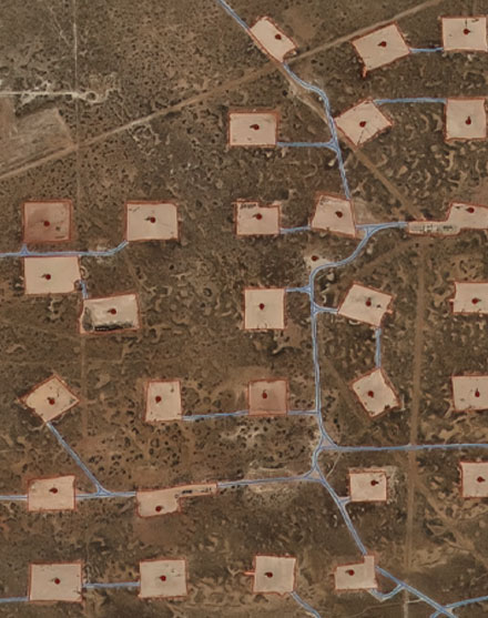
Planimetric Map of Permian Basin Well Sites

ACCURATE

Features are precisely plotted to provide a true representation of what you’re looking to track.

VITAL

Vector dataset delivers the exact information you need for calculations and classifications.

CLEAR

Highly visual maps provide an instant understanding of the structures you deem important.

Planimetric Mapping for PHMSA Compliance

Prius Intelli has seen a large uptick in demand for planimetric mapping from midstream customers seeking the data intelligence needed to meet Pipeline and Hazardous Materials Safety Administration (PHMSA) compliance requirements. PHMSA is a regulatory agency within the U.S. Department of Transportation that is responsible for ensuring the safe transportation of hazardous materials, including flammable and explosive materials, through pipelines, by rail, by air, and by road. 

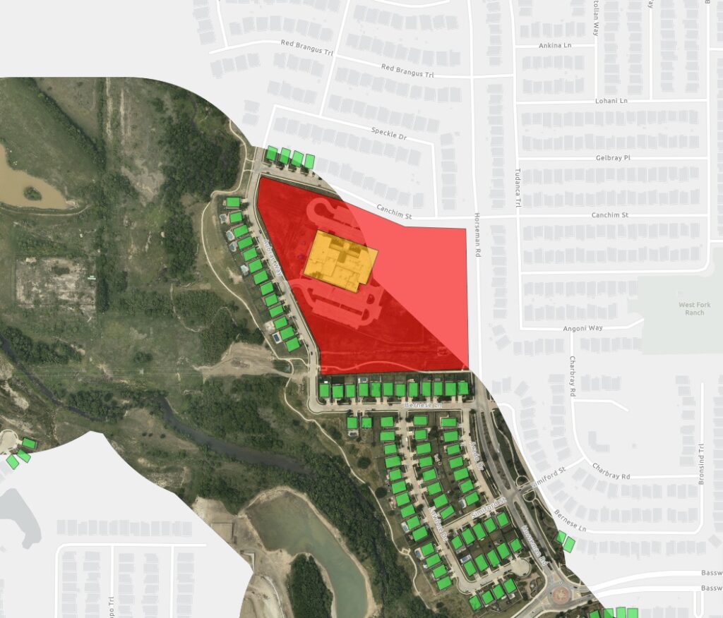
Hazardous materials like oil and natural gas must abide by restrictions when it comes to how it is transported – including how close pipelines may be placed near structuresMonitoring and reporting nearby development is critical, especially in relation to High Consequence Areas (HCAs). HCAs are defined by PHMSA as geographic areas where a pipeline failure could have significant impact on people, property, or the environment. These areas are typically identified based on factors such as population density, environmental sensitivity, and proximity to critical infrastructure or other assets. 

Planimetric mapping from Prius Intelli helps companies comply with PHMSA health and safety measures – more easily and cost-effectively – because it creates a vector dataset recording the location of objects along critical routes that can be used in calculations and classifications.    

Start your HCA planimetric mapping project today. 

The PHMSA requires operators of natural gas pipelines to identify and prioritize HCAs along their pipeline routes, and to implement additional safety measures in these areas to reduce the risk of incidents. For example, operators may be required to conduct more frequent inspections or use enhanced leak detection technologies in HCAs. The goal is to prevent accidents from occurring in these high-risk areas and to minimize the consequences if an incident does occur. 

Common Planimetric Map Requests

Civil:
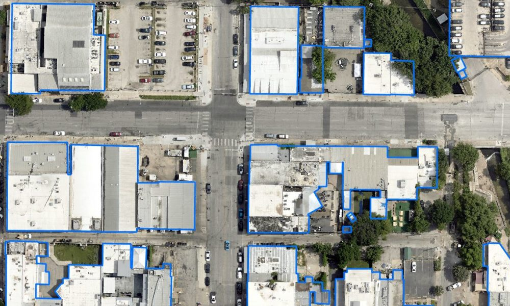
  • Building Footprints – Polygon
  • Fence Lines – Line
  • Roof Outlines -Polygon
  • Road Outlines – Polygon
  • Road Centerlines – Line
  • Road Striping – Line
  • Street Markings – Polygon
  • Water Features – Polygon
Utility:
  • Traffic Lights – Point
  • Storm Drains – Point
  • Manhole Covers – Point
  • Curbs – Lines
  • Landscape Boundaries – Line
  • Power Poles – Point
  • Light Poles – Point
Oil & Gas:
  • Pad Outlines – Polygon
  • Well Heads – Point
  • Flow Lines – Line
  • Tank Batteries – Polygon
  • Fence Lines – Line
  • Sludge Ponds – Polygon

Planimetric Map