High-Resolution Satellite Imagery: Is It Good Enough for Pipeline Route Planning?
High-Resolution Satellite Imagery: Is It Good Enough for Pipeline Route Planning?
High-Resolution Satellite Imagery: Is It Good Enough for Pipeline Route Planning?
High-Resolution Satellite Imagery: Is It Good Enough for Pipeline Route Planning?

When it comes to pipeline route planning, having access to accurate and detailed imagery is crucial. Companies rely on this data to make informed decisions, minimize costs, and reduce potential compliance issues. While high-resolution satellite imagery from providers like Maxar, INPE, and NASA offers resolutions up to 30 centimeters per pixel, several significant challenges arise when using this data for precise pipeline planning. In the following sections, we will explore these challenges then contrast these limitations with the advantages of Prius Intelli’s fixed-wing ultra-high resolution aerial imagery solution.
Satellite Imagery: A Closer Look
At first glance, high resolution satellite imagery with a resolution of 30 centimeters per pixel may seem like a sufficient solution for pipeline route planning. However, upon closer examination, several significant limitations become apparent. These limitations can have a profound impact on the accuracy, efficiency, and cost-effectiveness of the planning process.
Let’s take a closer look at three key challenges: positional inaccuracies, vector data misalignment, and outdated information. Also please note that these limitations apply to all types of industrial project planning, and even urban planning.
Positional Inaccuracies:
At 30 cm resolution, satellite imagery can contain substantial discrepancies between the locations shown in the images and the actual positions on the ground. These inaccuracies can cause deviations of 4-5 feet, which doesn’t sound significant for a project potentially spanning hundreds of miles. But such deviations can be highly problematic when tackling planning minutiae. A prime example of this is dealing with the questions and concerns of potentially hundreds of landowners. If the “on the ground” accuracy of the imagery can’t be trusted past a foot or two, a ground crew will need to be dispatched to address even the smallest of issues, which costs time and money.
Vector Data Misalignment:
When ground crews gather detailed information about a proposed pipeline route, such as roads, fences, and road crossings, it is crucial to accurately match this vector data with the imagery in their GIS systems and programs. However, satellite imagery often fails to align precisely with the preliminary data collected on the ground. Mismatches between satellite imagery and ground-level data can lead to incorrect assumptions about the feasibility of certain routes, the presence of obstacles, and the overall viability of the project. These errors can result in delays, increased costs, and potential conflicts with stakeholders.
Outdated Information:
Satellite imagery is captured at specific intervals determined by the provider, which means that the data may not always be up to date. Pipeline planners are at the mercy of when the provider decides to capture the imagery, which may not coincide with the project’s timeline or specific requirements. Relying on outdated information can lead to inaccurate assessments of the current conditions on the ground, potentially causing setbacks and increasing the likelihood of encountering unforeseen challenges during construction.
Prius Intelli’s Fixed-Wing Aerial Imagery Solution:
Prius Intelli offers a cutting-edge fixed-wing aircraft solution to capture ultra-high-resolution imagery using proprietary technology configurations with zero ground control measures required. This approach provides significant advantages over satellite imagery in terms of accuracy and timeliness.
Unparalleled Accuracy:
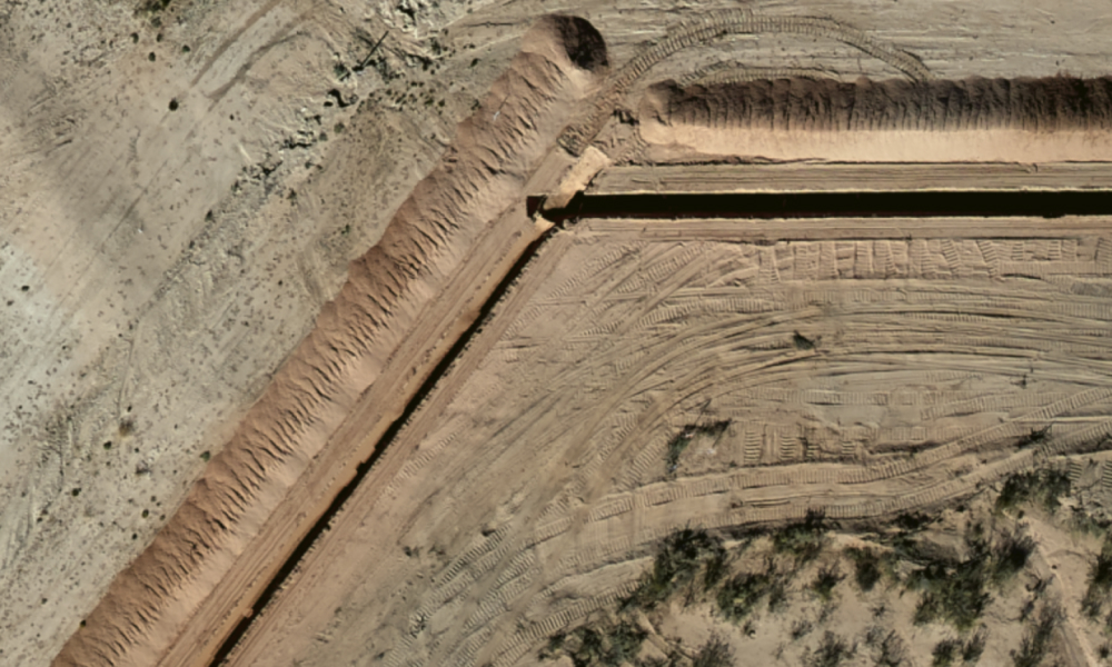
Prius Intelli’s aerial imagery achieves remarkable accuracy levels, with the lowest resolution (15 cm) providing a precision of approximately 18 inches. This level of exactness far surpasses the accuracy of satellite imagery, enabling pipeline planners to make informed decisions based on highly reliable data. As the resolution increases, the accuracy levels become even higher, ensuring that even the most intricate details of the pipeline route are captured with utmost precision.
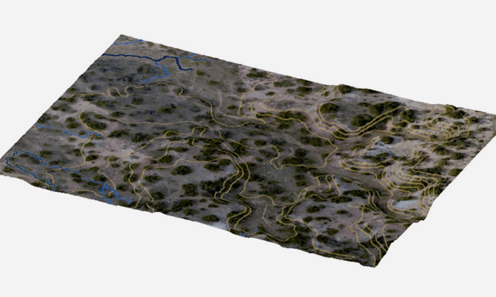
The high resolution of our RGB aerial imagery also facilitates the creation of accurate 3D models and digital elevation models (DEMs). These tools provide a comprehensive understanding of the terrain, allowing for the identification of potential challenges and the optimization of project plans accordingly. The ability to visualize the landscape in such detail greatly enhances the decision-making process and reduces the risk of unforeseen issues during execution.
On-Demand Data Capture:
One of the key advantages of Prius Intelli’s solution is the ability to fly on demand, capturing the intelligence you need exactly when you need it. Unlike satellite imagery, where you are dependent on the provider’s schedule, Prius Intelli’s fixed-wing solution allows you to request data capture at specific times that align with your project’s timeline. Our typical turn time from receipt of flyover requests is two to four weeks, weather dependent. This flexibility and timeliness ensure that you have access to the most up-to-date information, enabling you to make decisions based on the current conditions on the ground.
COMPLIANCE BONUS: Imagery captured on-demand can help midstream companies ensure compliance with Department of Transportation (DOT) and Pipeline and Hazardous Materials Safety Administration (PHMSA) regulations from the very beginning of the project. By providing a clear understanding of the paths of potential development along a centerline, this imagery enables planners to select the appropriate size of pipe for future population density. This foresight sets the stage for further cost savings and easier compliance in the future, as the pipeline infrastructure will be optimized for the anticipated growth and development in the area.
Seamless Integration:
Prius Intelli’s aerial imagery seamlessly integrates with the vector data collected by ground crews. The high accuracy levels ensure that the imagery aligns precisely with the ground-level information, eliminating the discrepancies often encountered with satellite imagery. This integration streamlines the planning process, reduces the risk of errors, and enables a more comprehensive understanding of the pipeline route.
In conclusion, while high-resolution satellite imagery may seem like a viable option for pipeline route planning, it falls short in terms of accuracy and timeliness. The inherent inaccuracies in 30 cm resolution, the misalignment with vector data, and the reliance on outdated information can lead to costly mistakes. Prius Intelli’s fixed-wing aerial imagery solution, with its proprietary technology configurations, offers unparalleled accuracy and on-demand data capture, empowering pipeline planners to make informed decisions based on reliable and up-to-date intelligence. By leveraging Prius Intelli’s expertise, companies can optimize their pipeline route planning process, minimize risks, and ensure the success of their projects.


