Exploring Geospatial Data Solutions: Mapping the World with Precision
Exploring Geospatial Data Solutions: Mapping the World with Precision
Exploring Geospatial Data Solutions: Mapping the World with Precision
Exploring Geospatial Data Solutions: Mapping the World with Precision

In today’s digital age, accurate and detailed spatial information has become crucial for a wide range of industries. Geospatial data solutions have emerged as powerful tools that harness the power of location-based data to provide valuable insights and drive informed decision-making. In this blog post, we will delve into the world of geospatial data solutions, focusing on the significance of on-demand orthoimagery and its role in creating high-resolution maps and 3D models for precise spatial analysis. We will also explore how this technology enhances operational efficiency in unique industries such as utilities and land development.
Understanding Geospatial Data Solutions
Geospatial data solutions encompass a range of technologies and processes that capture, manage, analyze, and visualize geographic information. They enable businesses and organizations to gather real-time location-based data, integrate it with existing systems, and gain valuable insights into their operations and surroundings.
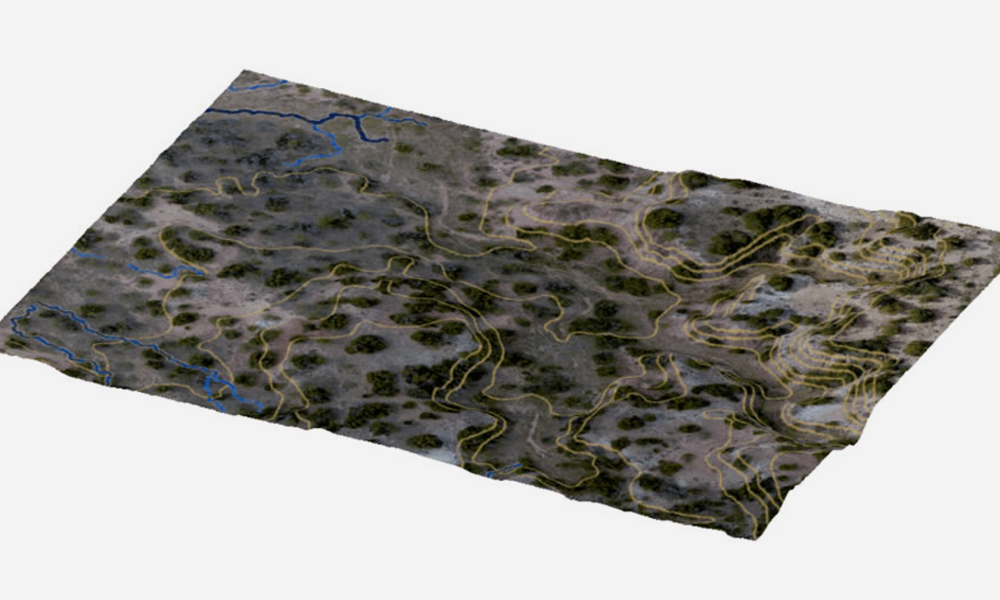
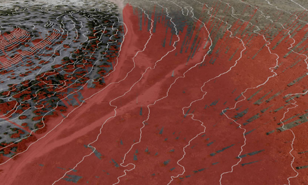
Unleashing High-Resolution Maps and 3D Models
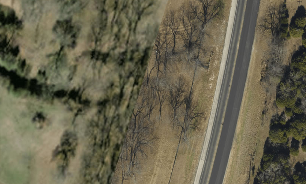
One key component of GIS is orthoimagery. Orthoimagery refers to aerial or satellite images that have been geometrically corrected to remove distortions caused by terrain and camera angles. These images provide an accurate representation of the Earth’s surface, allowing for precise mapping and modeling.
Get the most precise and up-to-date insight into your areas of interest with Prius Intelli. Our fixed-wing aircraft collect high-resolution orthoimagery on a project-by-project basis, giving businesses unparalleled clarity. This data is the foundation for detailed maps and 3D models, allowing professionals to visualize spatial information with exceptional accuracy. Experience the power of on-demand orthoimagery for a whole new level of precision.
GIS technology is extensively utilized in the utility industry and land development due to their ability to provide accurate spatial information and enhance operational efficiency. Here are a few more examples of how these solutions are applied in these industries:
Utility Infrastructure Planning and Management: Geospatial data solutions are instrumental in planning and managing utility infrastructure such as water and wastewater networks, electricity grids, and telecommunications systems. By integrating geospatial data with other relevant information like population density, land use patterns, and environmental factors, utility companies can optimize the placement of infrastructure assets, identify potential bottlenecks, and ensure efficient resource allocation.
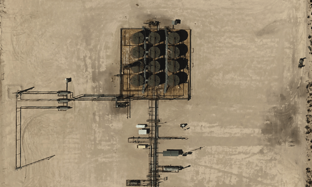
Asset Tracking and Maintenance: GIS data plays a crucial role in tracking and maintaining utility assets. Using real-time location data and remote sensing technologies, utility companies can monitor the condition and performance of their assets, such as pipelines, power lines, and substations. This allows for proactive maintenance and helps prevent costly failures and downtime by identifying potential issues before they escalate.
Land Development and Urban Planning: Geospatial data solutions are essential in land development and urban planning processes. They enable accurate mapping of land parcels, zoning regulations, and infrastructure requirements. By analyzing geospatial data, urban planners can assess the feasibility of development projects, optimize land use, and ensure compliance with regulatory guidelines. This results in more sustainable and well-designed communities.
Environmental Impact Assessment: In both the utility industry and land development, geospatial data solutions are used to assess and mitigate environmental impacts. By analyzing spatial data on ecosystems, protected areas, and sensitive habitats, professionals can identify potential risks and develop strategies to minimize adverse effects on the environment. This ensures that utility projects and land development activities are conducted in an environmentally responsible manner.
These examples illustrate how geospatial data solutions are leveraged in the utility industry and land development to improve decision-making, enhance operational efficiency, and minimize risks. By utilizing accurate and detailed spatial information, companies and organizations in these sectors can optimize their processes, reduce costs, and contribute to sustainable development.
Geospatial data solutions have revolutionized the way industries operate by providing accurate and detailed spatial information. The availability of on-demand orthoimagery by Prius Intelli allows for the creation of high-resolution maps and 3D models, enabling precise spatial analysis and informed decision-making. As technology continues to advance, we can expect geospatial data solutions to play an even more crucial role in shaping our world.
Be sure to follow Prius Intelli on LinkedIn.


