

How Geospatial Data Modeling Sheds Light on Reality
How Geospatial Data Modeling Sheds Light on Reality
How Geospatial Data Modeling Sheds Light on Reality
How Geospatial Data Modeling Sheds Light on Reality

Geospatial data modeling is continuing to play an essential role in establishing accurate models of reality for a wide variety of projects. The application of geospatial intelligence has and will continue to impact businesses, such as engineering, oil and gas, real estate, and more, through the implementation of more detailed and valuable models. Proper modeling allows geospatial data users to understand better the relationship of complex systems that vary over space or time. These geospatial data models provide information critical to more efficient risk analysis, land use planning, and even business decisions regarding where to expand.
Geospatial Data Modeling
Decades ago, the only option for creating 3D models of structures and terrain was to build physical miniature replicas or dioramas. Then, satellites and digital imaging delivered higher accuracy views that miniatures couldn’t compete with. In recent years, the advent of cloud computing has made digital geographic information systems more accessible by removing the barriers to taking advantage of these services.
But problems still arise. Budget, accuracy issues, lack of experience, and other obstacles can create challenges for companies utilizing GIS. Prius Intelli makes seeing the reality of your project more effortless than ever by pairing digital modeling with reliable orthoimagery and expert geospatial services.
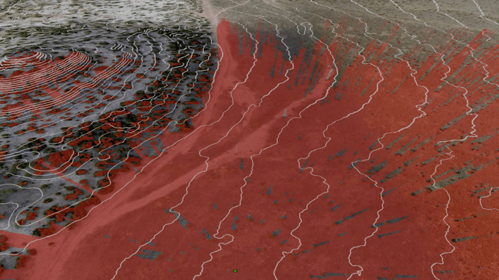
(Viewshed analysis from a point of interest)
What Makes Prius Intelli Different
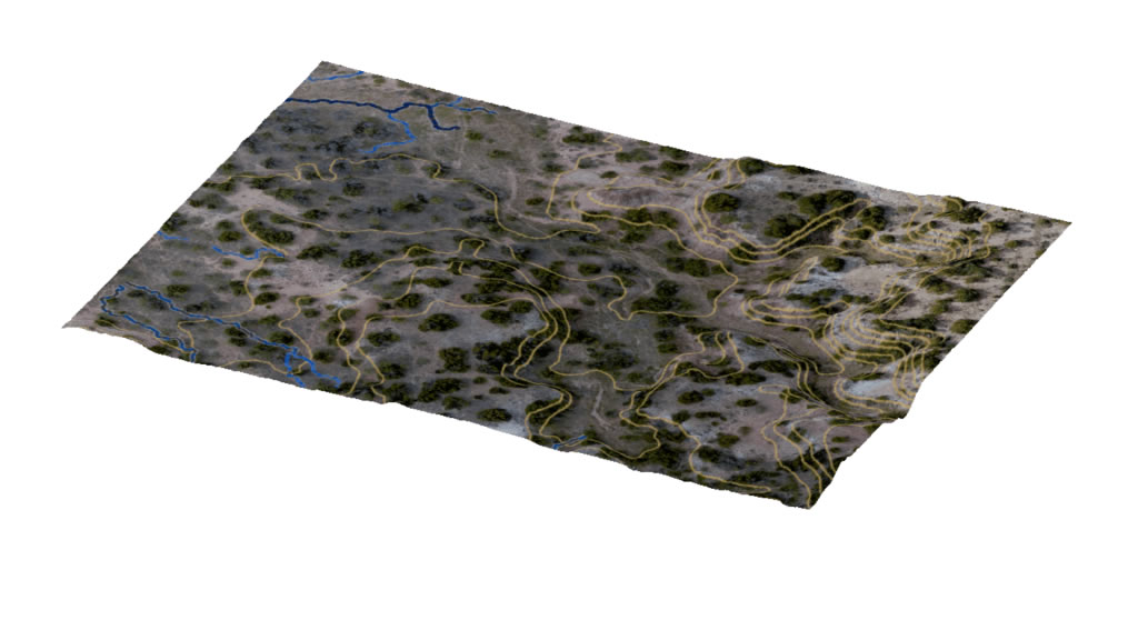
First, we use state-of-the-art technology to capture geospatial data to generate detailed documentation of topographic site conditions through digital elevation models created in the latest version of ESRI ArcGIS Pro. High-resolution data reduces the need for site visits and overcomes the limitations of human error.
Next, we pair that geospatial data with imagery captured of the site so you can see what’s on the ground in incredible detail. Our proprietary processing workflows produce seamless imagery with accuracy you can trust. So, you have the confidence knowing that the pixel resolution refers to the actual distance on the ground that each pixel represents in the aerial image.
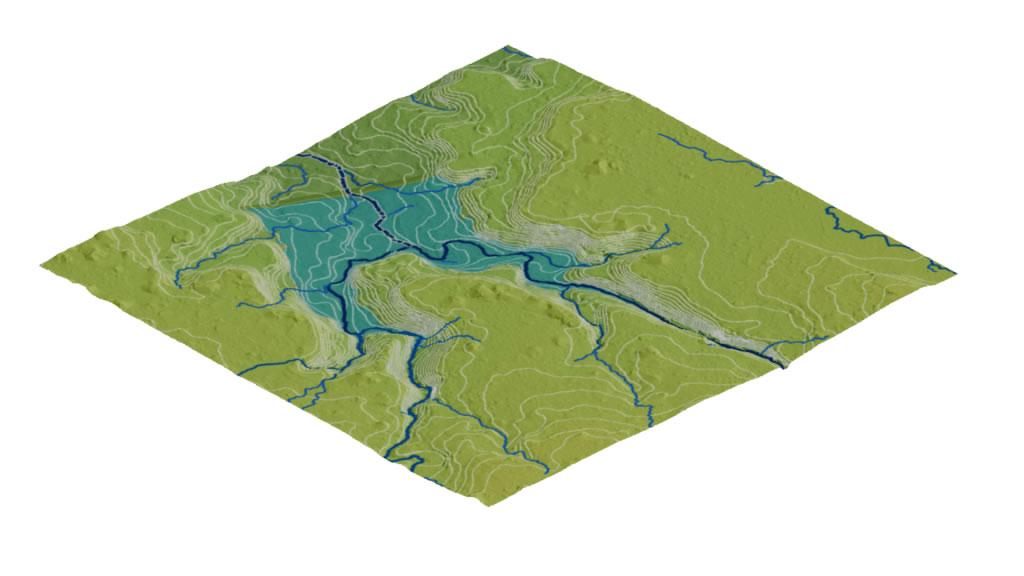
The accuracy and reliability of the geospatial data captured enable models to be built that can test scenarios under different conditions and empower users to explore creative ideas in their decision-making.
Finally, the resulting high-resolution geospatial data becomes an infinitely valuable tool for analysis and is prime for use in machine learning workflows to help improve understanding of your project over time.


Geospatial data modeling is continuing to play an essential role in establishing accurate models of reality for a wide variety of projects. The application of geospatial intelligence has and will continue to impact businesses, such as engineering, oil and gas, real estate, and more, through the implementation of more detailed and valuable models. Proper modeling allows geospatial data users to understand better the relationship of complex systems that vary over space or time. These geospatial data models provide information critical to more efficient risk analysis, land use planning, and even business decisions regarding where to expand.
Geospatial Data Modeling
Decades ago, the only option for creating 3D models of structures and terrain was to build physical miniature replicas or dioramas. Then, satellites and digital imaging delivered higher accuracy views that miniatures couldn’t compete with. In recent years, the advent of cloud computing has made digital geographic information systems more accessible by removing the barriers to taking advantage of these services.
But problems still arise. Budget, accuracy issues, lack of experience, and other obstacles can create challenges for companies utilizing GIS. Prius Intelli makes seeing the reality of your project more effortless than ever by pairing digital modeling with reliable orthoimagery and expert geospatial services.
(Viewshed analysis from a point of interest)
What Makes Prius Intelli Different
First, we use state-of-the-art technology to capture geospatial data to generate detailed documentation of topographic site conditions through digital elevation models created in the latest version of ESRI ArcGIS Pro. High-resolution data reduces the need for site visits and overcomes the limitations of human error.
Next, we pair that geospatial data with imagery captured of the site so you can see what’s on the ground in incredible detail. Our proprietary processing workflows produce seamless imagery with accuracy you can trust. So, you have the confidence knowing that the pixel resolution refers to the actual distance on the ground that each pixel represents in the aerial image.
The accuracy and reliability of the geospatial data captured enable models to be built that can test scenarios under different conditions and empower users to explore creative ideas in their decision-making.
Finally, the resulting high-resolution geospatial data becomes an infinitely valuable tool for analysis and is prime for use in machine learning workflows to help improve understanding of your project over time.

