

Why Aerial Imagery Resolution & Freshness Matter
Why Aerial Imagery Resolution & Freshness Matter
Why Aerial Imagery Resolution & Freshness Matter
Why Aerial Imagery Resolution & Freshness Matter

Important business decisions should never be based on inaccurate data. Having current, high-quality data is critical to any project’s success. With that same logic, it’s easy to see why the right resolution and data currency can make or break your aerial imagery. But what is data currency/freshness? How do you make sure you get high-quality and high resolution aerial imagery? To choose the best aerial imagery partner, it’s important to understand how aerial imagery is made and what impacts its quality.
What is aerial imagery and how is it produced?
Aerial imagery, also known as orthophotography, is the combination of aerial photos and data analytics. It is typically used in conjunction with GIS services, which help break down the data and make it usable.
Aerial imagery, also known as orthophotography, is the combination of aerial photos and data analytics. It is typically used in conjunction with GIS services, which help break down the data and make it usable. Since orthoimagery provides valuable geospatial data, it is used for a wide variety of projects and industries, including but not limited to the following:
- Oil & Gas
- Ranching
- Surveying & Land Services
- Real Estate
- Transportation
- Utilities
- Renewable Energy
Whether digging a ditch, building a subdivision, designing a pipeline, or assessing downed power lines, orthoimagery provides a detailed bird’s eye view that allows project managers to make the best decisions possible.
There are three main ways to get aerial images for your project: via satellite, drone (unmanned aircraft), or manned aircraft. Each method has its benefits and can vary differently in accuracy. Whichever method you choose, know that the key to accuracy lies in the image’s date of collection and spatial resolution.
What is data freshness/currency?
Data freshness or currency is simply how new the imagery is. So why does time matter with images? Because things change with time.
For example, many popular satellite data providers have imagery that spans the whole globe, but this imagery can be up to a few years old, especially in rural areas. It takes the satellite providers a long time to fully update their data. So it’s common for things on the ground to change between when the satellite image was created and when it is used.
Certain satellite companies do have imagery with a much higher temporal resolution (the time it takes to revisit and collect imagery for a certain place). However, those images are usually low in spatial resolution (blurry, pixelated). Also, tasking a satellite to cover the same area at a quick interval can be very expensive.
Other aerial imagery providers and satellite data companies will often blanket large areas, collecting massive amounts of data, then resell bits and pieces of it to companies that need the imagery. However, based on when the interested company is asking for the data, the imagery can become outdated very quickly.
At Prius Intelli, we produce aerial imagery on demand using our own manned aircraft. And we don’t collect imagery of an area until a customer orders it. This ensures that the data is up-to-date, so you’re getting a viewpoint into time very near to the present. You can learn more about how our services offer a great alternative to satellite and drone imagery here.
Spatial Resolution vs Data Freshness
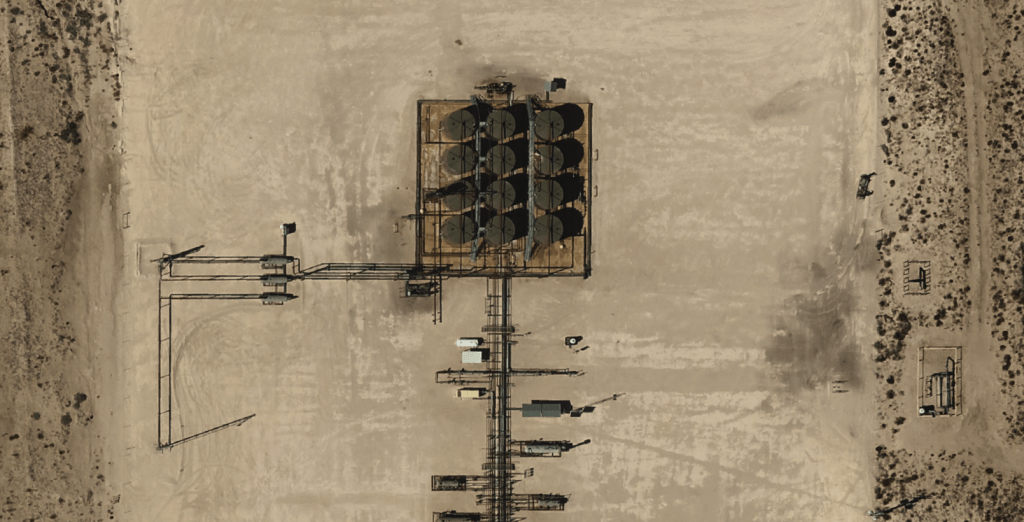
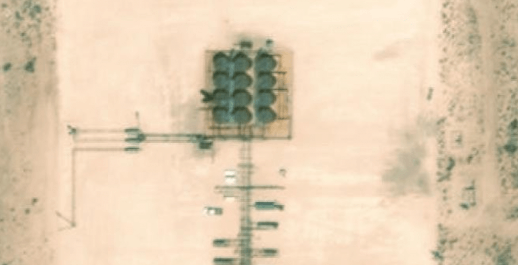
For aerial imagery, clarity and sharpness are just as important as the time in which it was flown. Spatial resolution describes the size of the pixels (and thus total number of pixels) in an image. The size of the pixels is relative to the size of what they represent on the ground. For instance, 5 cm resolution imagery means that each pixel represents 5 cm (2”) on the ground. The higher the spatial resolution, the clearer the image becomes. When an image has a low spatial resolution, details can become blurred or disappear altogether, which can be frustrating for the user.
If you are shopping for aerial imagery, look for resolution specs described in terms of centimeters or inches to understand the quality and clarity of images you’ll receive. However, that clarity means nothing if it is out-of-date. That’s why we produce images on demand instead of relying on historic databases.
When paired together, spatial resolution and data currency can produce incredible high-quality imagery, giving you the details and data you need to make informed decisions.
Is accuracy worth the investment?
For clients using aerial data to plan, proactively monitor, or perform diligence on important projects, positional accuracy and data freshness are difference makers. Poor quality aerial imagery can result in obsolete imagery, missed details, or outright inaccuracy. Because of the problems, low-quality images can cause, investing in high-quality imagery can be a money-saver later down the road.
However, the reality is that your budget can often define the accuracy of your photos – but it doesn’t have to. While satellite imagery can be cheaper, the spatial resolution may be less than desired (or outright useless for your use case). On the other hand, many companies offering high-quality images can have minimum cost thresholds that prevent smaller companies from participating. Our team has developed a proprietary workflow to produce high-quality orthoimages at an incredible value. Because we produce images on demand and have our own fleet of manned aircraft, we are able to deliver detailed images quickly, giving you the current data you need to succeed.


Important business decisions should never be based on inaccurate data. Having current, high-quality data is critical to any project’s success. With that same logic, it’s easy to see why the right resolution and data currency can make or break your aerial imagery. But what is data currency/freshness? How do you make sure you get high-quality and high resolution aerial imagery? To choose the best aerial imagery partner, it’s important to understand how aerial imagery is made and what impacts its quality.
What is aerial imagery and how is it produced?
Aerial imagery, also known as orthophotography, is the combination of aerial photos and data analytics. It is typically used in conjunction with GIS services, which help break down the data and make it usable.
Aerial imagery, also known as orthophotography, is the combination of aerial photos and data analytics. It is typically used in conjunction with GIS services, which help break down the data and make it usable. Since orthoimagery provides valuable geospatial data, it is used for a wide variety of projects and industries, including but not limited to the following:
- Oil & Gas
- Ranching
- Surveying & Land Services
- Real Estate
- Transportation
- Utilities
- Renewable Energy
Whether digging a ditch, building a subdivision, designing a pipeline, or assessing downed power lines, orthoimagery provides a detailed bird’s eye view that allows project managers to make the best decisions possible.
There are three main ways to get aerial images for your project: via satellite, drone (unmanned aircraft), or manned aircraft. Each method has its benefits and can vary differently in accuracy. Whichever method you choose, know that the key to accuracy lies in the image’s date of collection and spatial resolution.
What is data freshness/currency?
Data freshness or currency is simply how new the imagery is. So why does time matter with images? Because things change with time.
For example, many popular satellite data providers have imagery that spans the whole globe, but this imagery can be up to a few years old, especially in rural areas. It takes the satellite providers a long time to fully update their data. So it’s common for things on the ground to change between when the satellite image was created and when it is used.
Certain satellite companies do have imagery with a much higher temporal resolution (the time it takes to revisit and collect imagery for a certain place). However, those images are usually low in spatial resolution (blurry, pixelated). Also, tasking a satellite to cover the same area at a quick interval can be very expensive.
Other aerial imagery providers and satellite data companies will often blanket large areas, collecting massive amounts of data, then resell bits and pieces of it to companies that need the imagery. However, based on when the interested company is asking for the data, the imagery can become outdated very quickly.
At Prius Intelli, we produce aerial imagery on demand using our own manned aircraft. And we don’t collect imagery of an area until a customer orders it. This ensures that the data is up-to-date, so you’re getting a viewpoint into time very near to the present. You can learn more about how our services offer a great alternative to satellite and drone imagery here.
Spatial Resolution vs Data Freshness
For aerial imagery, clarity and sharpness are just as important as the time in which it was flown. Spatial resolution describes the size of the pixels (and thus total number of pixels) in an image. The size of the pixels is relative to the size of what they represent on the ground. For instance, 5 cm resolution imagery means that each pixel represents 5 cm (2”) on the ground. The higher the spatial resolution, the clearer the image becomes. When an image has a low spatial resolution, details can become blurred or disappear altogether, which can be frustrating for the user.
If you are shopping for aerial imagery, look for resolution specs described in terms of centimeters or inches to understand the quality and clarity of images you’ll receive. However, that clarity means nothing if it is out-of-date. That’s why we produce images on demand instead of relying on historic databases.
When paired together, spatial resolution and data currency can produce incredible high-quality imagery, giving you the details and data you need to make informed decisions.
Is accuracy worth the investment?
For clients using aerial data to plan, proactively monitor, or perform diligence on important projects, positional accuracy and data freshness are difference makers. Poor quality aerial imagery can result in obsolete imagery, missed details, or outright inaccuracy. Because of the problems, low-quality images can cause, investing in high-quality imagery can be a money-saver later down the road.
However, the reality is that your budget can often define the accuracy of your photos – but it doesn’t have to. While satellite imagery can be cheaper, the spatial resolution may be less than desired (or outright useless for your use case). On the other hand, many companies offering high-quality images can have minimum cost thresholds that prevent smaller companies from participating. Our team has developed a proprietary workflow to produce high-quality orthoimages at an incredible value. Because we produce images on demand and have our own fleet of manned aircraft, we are able to deliver detailed images quickly, giving you the current data you need to succeed.

