

7 Best Ways to Use Orthoimagery
7 Best Ways to Use Orthoimagery
7 Best Ways to Use Orthoimagery
7 Best Ways to Use Orthoimagery

While aerial photography provides bird’s-eye images of the surface, orthoimagery takes it a step further by combining it with the benefits of enhanced maps. From pipeline development to real estate valuation, many industries depend on this accurate, up-to-date information about land to make key decisions. Erroneous or outdated information can cause major delays “ or worse. That’s why accurate, real-time imagery is imperative to the success of any business. While some of the use cases for orthophotography may be obvious, you might be surprised at all the ways it can be used:
Orthoimagery is the process by which an aerial or satellite image is geometrically “corrected” (ortho rectified) for uniformity from edge to edge.
1. UPSTREAM OIL GAS
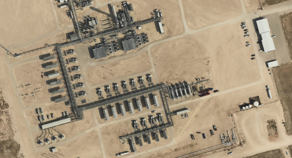
Those in the oil and gas industry can benefit greatly from orthophotography. Specifically, orthophotos can be used for surface monitoring and change detection and tracking in upstream projects to give an updated look of a project’s process. While many in this field opt for pre-existing satellite imagery, those images can be outdated and don’t provide the accuracy and resolution of custom orthophotography.
2. MIDSTREAM OIL GAS
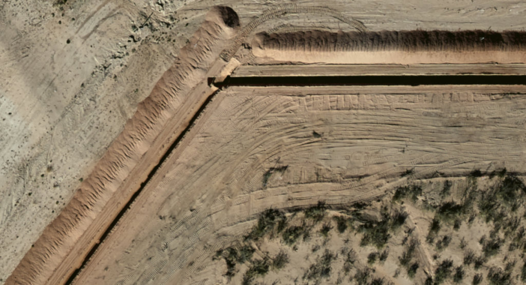
Orthoimagery is also incredibly valuable for midstream businesses and the use cases are many. We’ve seen orthoimagery used for a variety of projects, including route planning, right-of-way encroachment, construction monitoring, pipeline classification, PHMSA compliance studies and overall line monitoring. Specifically for pipelines, orthophotos provide the accuracy needed to confidently break ground on a new pipeline and comply with the necessary safety guidelines.
3. RANCHING HUNTING
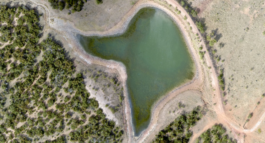
When ranching, it’s key to have an intimate understanding of your property. That’s why the terrain and elevation data collected during an orthoimagery project can be extremely useful to ranch brokers. Water-related data like stream networks, basins, and contour lines can inform surface water decisions regarding livestock and other ranching needs. Additionally, viewshed data can be used for building blinds when hunting is allowed on the land.
4. SURVEYING LAND SERVICES
Orthophotography can be a cost-effective way to gather key data used in surveying and land-related services. When used in the planning stage, high-resolution orthophotos can provide a strong foundation of knowledge for project leads and engineers. Instead of choosing traditional methods that are often expensive and time-consuming, orthoimagery can provide a more affordable alternative that’s just as useful.
5. REAL ESTATE (DEVELOPMENT VALUATION)
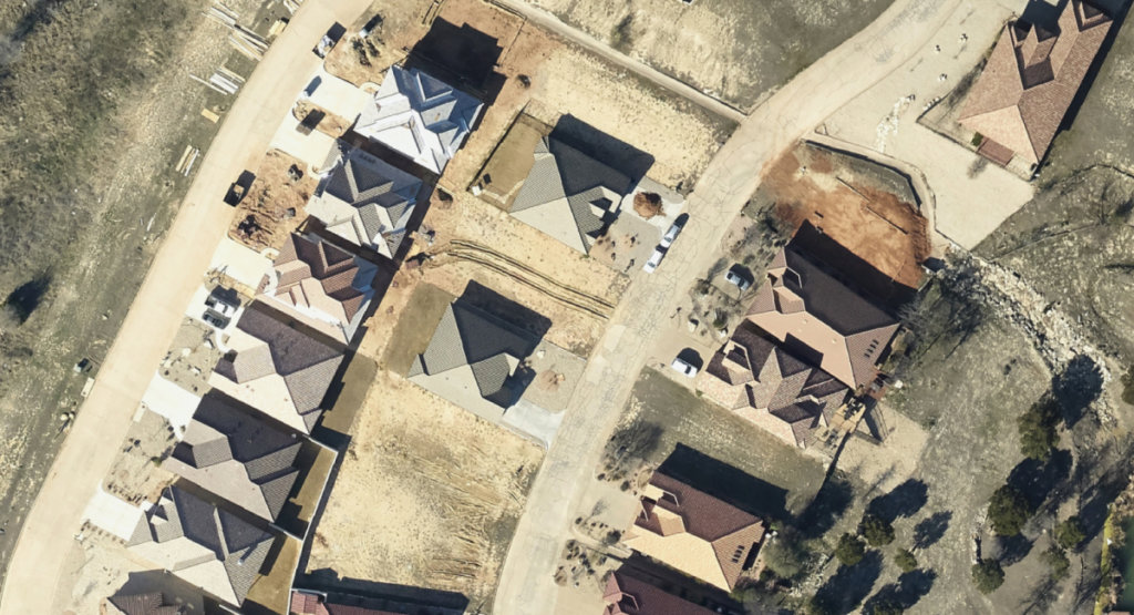
The data collected from orthoimagery is incredibly valuable for real estate developers, appraisals and valuations. Consider the water-related data, contour lines, slope rasters and elevation data available in a properly developed aerial image. This data can be used to plan out retention ponds, determine areas of high erosion, project planning and more. Plus, unlike satellite imagery that is often of a wider area than needed (not to mention obsolete), orthoimagery can be made of specific locations for more accurate, time-sensitive information.
6. UTILITIES
While helpful in planning stages of most relevant industries, orthoimagery can also help businesses respond to unplanned events. Consider the utilities industry. After a large storm, an orthoimage of the affected area can help identify downed power lines and poles much more effectively than doing physical drive-bys. As another example, orthoimages can help monitor tree overgrowth so utility personnel can maintain the integrity of the power lines over time. Knowledge is power “ and the data from aerial imagery can empower your business to respond effectively whenever the unexpected occurs.
7. RENEWABLE ENERGY
A lot goes into the planning and development of renewable energy products. For example, solar farms require detailed analysis to meet slope requirements and dam construction requires an informed understanding of the streams and run-off systems in the area. Orthoimagery and its related GIS services can provide all this and more. When processed properly, aerial imagery and elevation data can provide a real-time understanding of the environment, allowing you to use an area’s natural resources as effectively and efficiently as possible.
THE RIGHT HIGH-RESOLUTION ORTHOPHOTOGRAPHY MATTERS.
At Prius Intelli, we know how important it is to understand the value of your project’s environment. Our dedicated team delivers accurate, high-resolution orthophotography, GIS services, and elevation data on demand and at an incredible value. We collect our imagery on an order-by-order basis, so your data is gathered in real-time and delivered on time. For more on how we can help your business, reach out today for a custom consultation and a free quote.


While aerial photography provides bird’s-eye images of the surface, orthoimagery takes it a step further by combining it with the benefits of enhanced maps. From pipeline development to real estate valuation, many industries depend on this accurate, up-to-date information about land to make key decisions. Erroneous or outdated information can cause major delays “ or worse. That’s why accurate, real-time imagery is imperative to the success of any business. While some of the use cases for orthophotography may be obvious, you might be surprised at all the ways it can be used:
Orthoimagery is the process by which an aerial or satellite image is geometrically “corrected” (ortho rectified) for uniformity from edge to edge.
1. UPSTREAM OIL GAS
Those in the oil and gas industry can benefit greatly from orthophotography. Specifically, orthophotos can be used for surface monitoring and change detection and tracking in upstream projects to give an updated look of a project’s process. While many in this field opt for pre-existing satellite imagery, those images can be outdated and don’t provide the accuracy and resolution of custom orthophotography.
2. MIDSTREAM OIL GAS
Orthoimagery is also incredibly valuable for midstream businesses and the use cases are many. We’ve seen orthoimagery used for a variety of projects, including route planning, right-of-way encroachment, construction monitoring, pipeline classification, PHMSA compliance studies and overall line monitoring. Specifically for pipelines, orthophotos provide the accuracy needed to confidently break ground on a new pipeline and comply with the necessary safety guidelines.
3. RANCHING HUNTING
When ranching, it’s key to have an intimate understanding of your property. That’s why the terrain and elevation data collected during an orthoimagery project can be extremely useful to ranch brokers. Water-related data like stream networks, basins, and contour lines can inform surface water decisions regarding livestock and other ranching needs. Additionally, viewshed data can be used for building blinds when hunting is allowed on the land.
4. SURVEYING LAND SERVICES
Orthophotography can be a cost-effective way to gather key data used in surveying and land-related services. When used in the planning stage, high-resolution orthophotos can provide a strong foundation of knowledge for project leads and engineers. Instead of choosing traditional methods that are often expensive and time-consuming, orthoimagery can provide a more affordable alternative that’s just as useful.
5. REAL ESTATE (DEVELOPMENT VALUATION)
The data collected from orthoimagery is incredibly valuable for real estate developers, appraisals and valuations. Consider the water-related data, contour lines, slope rasters and elevation data available in a properly developed aerial image. This data can be used to plan out retention ponds, determine areas of high erosion, project planning and more. Plus, unlike satellite imagery that is often of a wider area than needed (not to mention obsolete), orthoimagery can be made of specific locations for more accurate, time-sensitive information.
6. UTILITIES
While helpful in planning stages of most relevant industries, orthoimagery can also help businesses respond to unplanned events. Consider the utilities industry. After a large storm, an orthoimage of the affected area can help identify downed power lines and poles much more effectively than doing physical drive-bys. As another example, orthoimages can help monitor tree overgrowth so utility personnel can maintain the integrity of the power lines over time. Knowledge is power “ and the data from aerial imagery can empower your business to respond effectively whenever the unexpected occurs.
7. RENEWABLE ENERGY
A lot goes into the planning and development of renewable energy products. For example, solar farms require detailed analysis to meet slope requirements and dam construction requires an informed understanding of the streams and run-off systems in the area. Orthoimagery and its related GIS services can provide all this and more. When processed properly, aerial imagery and elevation data can provide a real-time understanding of the environment, allowing you to use an area’s natural resources as effectively and efficiently as possible.
THE RIGHT HIGH-RESOLUTION ORTHOPHOTOGRAPHY MATTERS.
At Prius Intelli, we know how important it is to understand the value of your project’s environment. Our dedicated team delivers accurate, high-resolution orthophotography, GIS services, and elevation data on demand and at an incredible value. We collect our imagery on an order-by-order basis, so your data is gathered in real-time and delivered on time. For more on how we can help your business, reach out today for a custom consultation and a free quote.

