

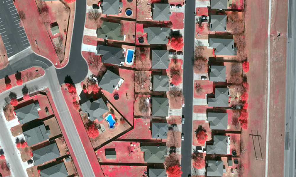
Announcing High-Resolution Imagery – Structure ID® by Prius Intelli
Learn how Digital Surface Models (DSMs) are created and how they empower decision-making in various industries. Explore a real-life case study of a renewable energy company using DSMs and high-resolution aerial imagery.
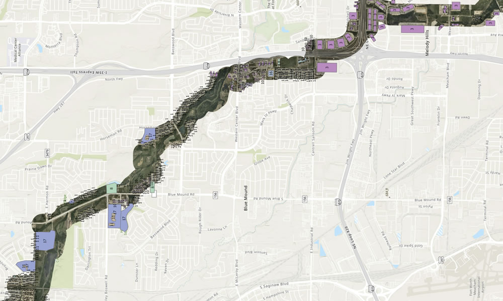
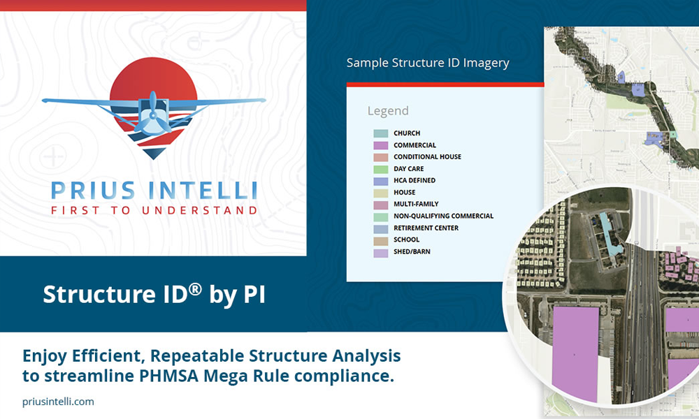
Aerial Surveys & Structure ID: Easing the Burden of PHMSA Compliance
Identifying structures for pipeline class location and HCA and MCA identification is a labor-intensive process that has been historically undertaken by ground crews.

Remote Sensing Technology in the Oilfield: Exploring Aerial Options
Remote sensing technology gathers information about an object or area from a distance. It involves the use of sensors mounted on drones, aircraft, or satellites to collect electromagnetic radiation emitted or reflected by objects on Earth's surface.
Change Detection: A “Practicable Step” for Monitoring Changing Ground Conditions?
Change detection technology has revolutionized how many industries monitor and analyze changes across their Areas of Interest. Here we explore how GIS change detection may be used to protect ROWs against geohazards and depth of cover issues.
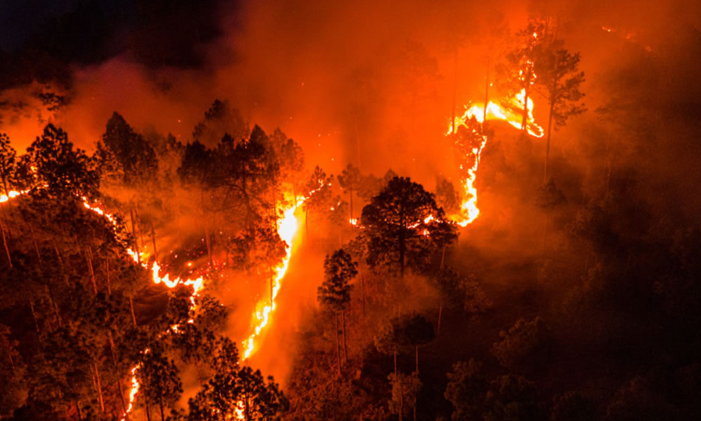
Wildfire Risk Maps: Fighting Wildfire Risk with Aerial Imagery & GIS Modeling
Wildfires in the United States can have a devastating impact on people, property, and the environment. Wildfire risk maps may hold the key to helping mitigate costly damage.
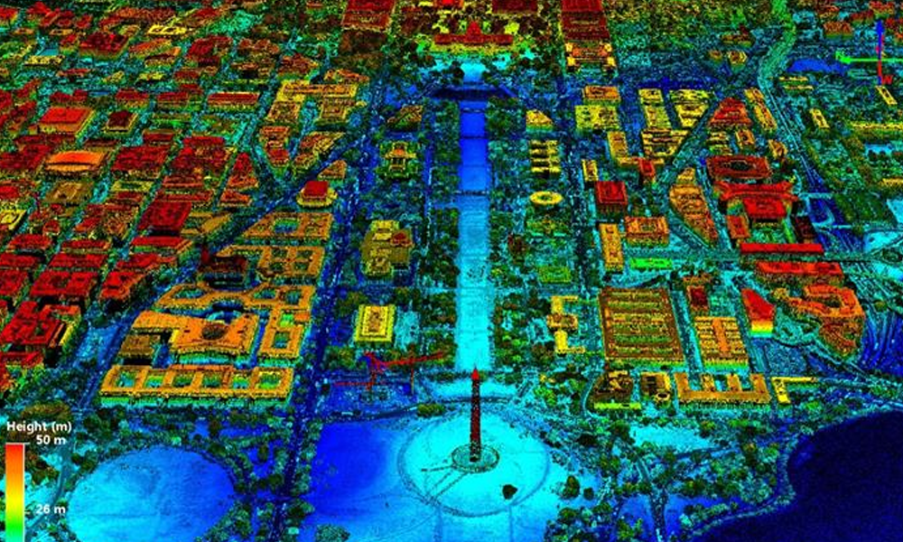
Prius Intelli expands its product offering with LiDAR and 4-band imagery
Texas-based Prius Intelli expands its product offering with LiDAR and 4-band imagery to its ever-growing portfolio of aerial imagery products and services.
LiDAR Speeds Gas Migration Control Compared to Ground Inspection
Aerial photography with LiDAR helps speed gas migration control repair and cleanup, minimizing damage to the environment and danger to people.

