

The Benefits of On-demand Aerial Imagery
The Benefits of On-demand Aerial Imagery
The Benefits of On-demand Aerial Imagery
The Benefits of On-demand Aerial Imagery

Give clients exactly what they need with fresh, on-demand aerial imagery.
As the available workforce shrinks on one side and service costs balloon on the other, your site-location procedures are caught in the middle. How does a company effectively evaluate things like elevation, contours, the proximity of infrastructure, population, and other factors without enough boots on the ground?
And if the boots were available, they’re costly and they could be doing something more productive than driving around the site with a camera and surveying tools.
But current online aerial data is at least several months old (maybe several years old), is not very detailed, and may not be configured to fit the prospective location.
The best aerial imagery is timely.
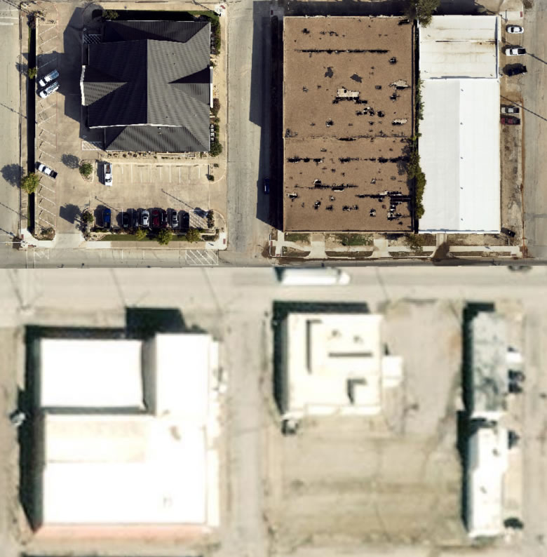
On-demand aerial data is giving an increasing number of producers the resources they need to efficiently and accurately evaluate sites for drill pads, tank batteries, processing facilities, and a wide variety of operations. The data and images are gathered when they’re needed and they cover the exact area required for the site.
The best aerial imagery is detailed.
On-demand aerial imagery is also fine-tuned to the resolution each user requires. If the survey is just for nearby infrastructure, lower resolution may be fine. If the needs are for identifying vegetation or endangered species, or for terrain modeling, the imagery can be collected at a resolution as high as 2.5 cm or as wide as 15 cm.
The best aerial imagery is useful.
With more emphasis on environmental concerns, regulators are also fining companies for disturbing wildlife migration patterns or disturbing wetlands. Drainage issues may also come into play. With its ability to quickly provide detailed data across hundreds of miles, aerial imagery is helping many companies manage these concerns as well.
Aerial data is much more cost-effective and time-efficient than sending people to inspect the site and the surrounding area. Results are faster because there is no need for individuals to share, compare and collect the data manually—it’s all done electronically.
The best aerial imagery is precise.
GIS data is also available for precise mapping of pipeline locations and other infrastructure. Midstream companies doing route/re-route planning and evaluating regulatory compliance can use aerial services to collect data over long distances quickly and very cost-effectively. It is also extremely valuable for class location studies—evaluating the proximity of businesses or residences, which informs regulatory and safety requirements for pipelines based on the potential danger to populations in case of a leak or other situation.
Pipeline class changes on existing lines are completely independent of any midstream company activity. They revolve around population spread—new subdivisions, apartments, shopping centers, or office buildings/warehouses being built nearby. These are the considerations.
Using employees to drive the long miles presents the drawbacks of the costs of time and vehicle expense, plus the concerns that some sections of the proposed path may not be accessible by public roads. Aerial collection overcomes all those concerns.


Give clients exactly what they need with fresh, on-demand aerial imagery.
As the available workforce shrinks on one side and service costs balloon on the other, your site-location procedures are caught in the middle. How does a company effectively evaluate things like elevation, contours, the proximity of infrastructure, population, and other factors without enough boots on the ground?
And if the boots were available, they’re costly and they could be doing something more productive than driving around the site with a camera and surveying tools.
But current online aerial data is at least several months old (maybe several years old), is not very detailed, and may not be configured to fit the prospective location.
The best aerial imagery is timely.
On-demand aerial data is giving an increasing number of producers the resources they need to efficiently and accurately evaluate sites for drill pads, tank batteries, processing facilities, and a wide variety of operations. The data and images are gathered when they’re needed and they cover the exact area required for the site.
The best aerial imagery is detailed.
On-demand aerial imagery is also fine-tuned to the resolution each user requires. If the survey is just for nearby infrastructure, lower resolution may be fine. If the needs are for identifying vegetation or endangered species, or for terrain modeling, the imagery can be collected at a resolution as high as 2.5 cm or as wide as 15 cm.
The best aerial imagery is useful.
With more emphasis on environmental concerns, regulators are also fining companies for disturbing wildlife migration patterns or disturbing wetlands. Drainage issues may also come into play. With its ability to quickly provide detailed data across hundreds of miles, aerial imagery is helping many companies manage these concerns as well.
Aerial data is much more cost-effective and time-efficient than sending people to inspect the site and the surrounding area. Results are faster because there is no need for individuals to share, compare and collect the data manually—it’s all done electronically.
The best aerial imagery is precise.
GIS data is also available for precise mapping of pipeline locations and other infrastructure. Midstream companies doing route/re-route planning and evaluating regulatory compliance can use aerial services to collect data over long distances quickly and very cost-effectively. It is also extremely valuable for class location studies—evaluating the proximity of businesses or residences, which informs regulatory and safety requirements for pipelines based on the potential danger to populations in case of a leak or other situation.
Pipeline class changes on existing lines are completely independent of any midstream company activity. They revolve around population spread—new subdivisions, apartments, shopping centers, or office buildings/warehouses being built nearby. These are the considerations.
Using employees to drive the long miles presents the drawbacks of the costs of time and vehicle expense, plus the concerns that some sections of the proposed path may not be accessible by public roads. Aerial collection overcomes all those concerns.

