

Ecological Remediation Accelerated Using GIS Services
Ecological Remediation Accelerated Using GIS Services
Ecological Remediation Accelerated Using GIS Services
Ecological Remediation Accelerated Using GIS Services

In spite of careful training, the latest equipment and monitoring devices, and the best-laid plans—a spill can still happen on a rare occasion. When it does, the first question revolves around, “How fast can we remediate the area and how can we limit the encroachment on the ecology?” Ecological remediation requires fast action.
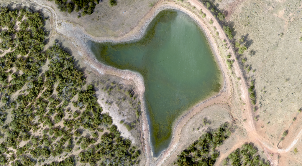
The first step in solving any issue is knowledge. Where is the spill, where is it flowing, and what structures, land, and vegetation is in its path? On most oil, mining, or industrial sites, the fastest way to get the big picture is through detailed, on-demand aerial photography. Whether the spill is oil, industrial chemicals, brine, or even a flood of clean water the results must be managed and contained.
Ecological remediation or environmental remediation is the removal of contaminants from soil, groundwater, surface water, etc.
Why use aerial data?
By using aerial data combined with our GIS mapping you can quickly get the “big picture,” literally. While boots on the ground are still vital to shutting off valves and possibly removing equipment from harm’s way, no set of ground-based eyes will give you an immediate view of the entire scope of the spill. People on the ground will not be able to provide the elevation details and slope information or aggregate all their findings in the ways available from aerial imagery.
This is simply the fastest and most efficient way to allocate remediation resources and save time, money, and the environment.
Aerial imagery provides immediate results.
Once your people or systems detect and stop the leak, the cleanup begins. We can on short order arrange to capture aerial images that can show you everything you need to know. With slope measurements and elevations we can track likely flow directions, helping you visualize runoff for the spill areas that are visible from the air. This lets your people focus on where the liquids are and where they may be headed.
For instance, we can filter the data to show the exact degree of slope in any spot. This data helps identify areas subject to sloughing, which would not only predict direction and speed of flow, but would show what structures or equipment could be in danger of being damaged by the runoff. This is especially important in instances of high flow discharges such as a storage tank or high-pressure flowline.
Assuming the leak was located and stopped, there may be temptation to think GIS-based elevations and slope measurements are unnecessary—after all, the flow has stopped!
There are still at least two areas of concern even after stoppage. What if it rains? Without this data, rain runoff could spread contaminants into unexpected areas. What if the cleanup process releases more runoff? Again, predictive flow modeling helps your people create dikes or channels to contain any additional activity.
Long-term monitoring is key.
Even with immediate ecological remediation, a spill’s long-term effects on vegetation and wildlife may be delayed by weeks or months. Periodic aerial data can reveal these and any other changes, alerting you to any further remediation needed to comply with regulators and landowners.
As Much Detail as You Need
We collect our imagery using manned fixed-wing aircraft equipped with state-of-the-art sensors capable of resolutions ranging from 2.5-15 cm. This provides current, crisp data on any project. For GIS mapping, we process the information through advanced analytics to provide comprehensive base maps with geospatial data and analysis.
Ready to learn more about protecting your people, property, and investment with aerial data and GIS mapping services? Contact us at 888-717-6277 or request a quote here.


In spite of careful training, the latest equipment and monitoring devices, and the best-laid plans—a spill can still happen on a rare occasion. When it does, the first question revolves around, “How fast can we remediate the area and how can we limit the encroachment on the ecology?” Ecological remediation requires fast action.
The first step in solving any issue is knowledge. Where is the spill, where is it flowing, and what structures, land, and vegetation is in its path? On most oil, mining, or industrial sites, the fastest way to get the big picture is through detailed, on-demand aerial photography. Whether the spill is oil, industrial chemicals, brine, or even a flood of clean water the results must be managed and contained.
Ecological remediation or environmental remediation is the removal of contaminants from soil, groundwater, surface water, etc.
Why use aerial data?
By using aerial data combined with our GIS mapping you can quickly get the “big picture,” literally. While boots on the ground are still vital to shutting off valves and possibly removing equipment from harm’s way, no set of ground-based eyes will give you an immediate view of the entire scope of the spill. People on the ground will not be able to provide the elevation details and slope information or aggregate all their findings in the ways available from aerial imagery.
This is simply the fastest and most efficient way to allocate remediation resources and save time, money, and the environment.
Aerial imagery provides immediate results.
Once your people or systems detect and stop the leak, the cleanup begins. We can on short order arrange to capture aerial images that can show you everything you need to know. With slope measurements and elevations we can track likely flow directions, helping you visualize runoff for the spill areas that are visible from the air. This lets your people focus on where the liquids are and where they may be headed.
For instance, we can filter the data to show the exact degree of slope in any spot. This data helps identify areas subject to sloughing, which would not only predict direction and speed of flow, but would show what structures or equipment could be in danger of being damaged by the runoff. This is especially important in instances of high flow discharges such as a storage tank or high-pressure flowline.
Assuming the leak was located and stopped, there may be temptation to think GIS-based elevations and slope measurements are unnecessary—after all, the flow has stopped!
There are still at least two areas of concern even after stoppage. What if it rains? Without this data, rain runoff could spread contaminants into unexpected areas. What if the cleanup process releases more runoff? Again, predictive flow modeling helps your people create dikes or channels to contain any additional activity.
Long-term monitoring is key.
Even with immediate ecological remediation, a spill’s long-term effects on vegetation and wildlife may be delayed by weeks or months. Periodic aerial data can reveal these and any other changes, alerting you to any further remediation needed to comply with regulators and landowners.
As Much Detail as You Need
We collect our imagery using manned fixed-wing aircraft equipped with state-of-the-art sensors capable of resolutions ranging from 2.5-15 cm. This provides current, crisp data on any project. For GIS mapping, we process the information through advanced analytics to provide comprehensive base maps with geospatial data and analysis.
Ready to learn more about protecting your people, property, and investment with aerial data and GIS mapping services? Contact us at 888-717-6277 or request a quote here.

