

Elevating Airport Planning with High-Resolution Aerial Imagery
Elevating Airport Planning with High-Resolution Aerial Imagery
Elevating Airport Planning with High-Resolution Aerial Imagery
Elevating Airport Planning with High-Resolution Aerial Imagery

Airports, whether large international hubs or smaller regional facilities, face the common challenge of efficiently managing their complex infrastructure. From monitoring construction projects to planning future developments, having access to accurate and up-to-date imagery is crucial. This is where Prius Intelli's innovative aerial imagery solutions come into play, offering airports of all sizes a powerful tool to streamline airport planning and management, and make better informed decisions.
Bridging the Gap Between Satellite and Drone Imagery
Traditionally, airports have relied on two primary sources of imagery: satellite imagery and drone-captured images. While both have their merits, they also have limitations. Satellite imagery provides broad coverage but often lacks the necessary resolution for detailed analysis. For regional airports, satellite coverage can also be sparse and expensive. Worse, it can be outdated, which can be more harmful than helpful to planning efforts. Drone imagery, on the other hand, offers high-resolution data captured when it's needed – but is limited in terms of area coverage and can be time-consuming to acquire. In addition, all but the smallest airports are controlled airspace, which can make receiving permits, not to mention actual flight operations, a challenge. Prius Intelli's on-demand aerial imagery services fill the gap between these two options, providing the perfect balance of resolution, coverage, ease of capture, and temporal accuracy.
GET A QUOTE FOR YOUR AIRPORT TODAY
The Prius Intelli Advantage
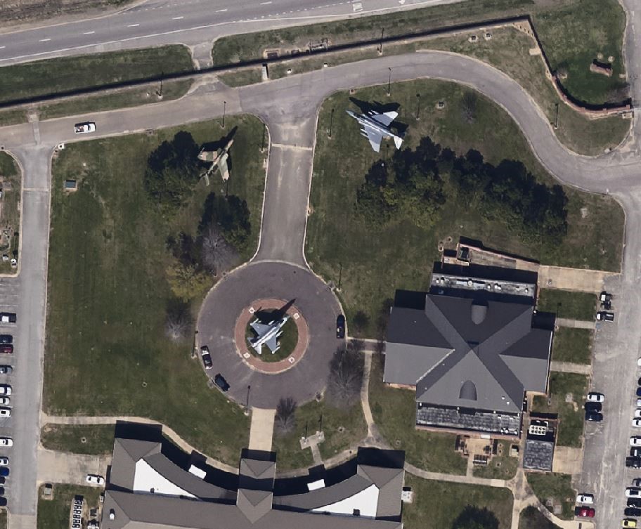
Prius Intelli utilizes advanced fixed-wing aircraft equipped with state-of-the-art cameras and GPS sensors to capture high-quality aerial imagery. By flying at optimal altitudes, Prius Intelli can deliver images with remarkable detail, offering resolutions as high as four inches per pixel. This level of detail is ideal for airports, as it allows for precise mapping and analysis of their infrastructure, from runways and taxiways to buildings and parking areas.
Cost-Effective and Efficient Data Acquisition
One of the standout features of Prius Intelli's aerial imagery solution is its cost-effectiveness. Unlike traditional methods that often require ground control markers, Prius Intelli's advanced technology eliminates this need, saving airports time and resources. Many airports choose to commission aerial imagery annually, and Prius Intelli's streamlined process ensures they receive the data they need without straining their budgets.
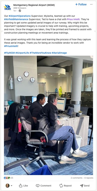
Project Spotlight: Montgomery Regional Airport
Prius Intelli recently demonstrated the transformative potential of our aerial imagery solutions for regional airports. A quick call with Myiesha, Supervisor of Airport Operations, revealed a common challenge faced by many regional facilities: the need for high-quality imagery in areas where satellite data is sparse and expensive.
Recognizing the opportunity to provide a tailored solution, we quickly prepared a quote for 15cm resolution imagery of Montgomery Regional Airport's exact footprint. The proposed solution not only met the airport's needs but also fit well within their budget. The only question remaining: How fast could we deliver? We quoted a pretty standard 4-6 week turn. Satisfied with the quick turnaround time and budget-friendly solution, the airport promptly signed the quote, eager to leverage Prius Intelli's expertise to enhance their construction planning and training operations.
GET A QUOTE FOR YOUR AIRPORT TODAY
Versatile Applications for Airport Management
Airports can utilize the high-quality aerial imagery provided by Prius Intelli in various ways. One of the primary applications is creating base maps for exhibits and construction projects. The detailed imagery allows airports to plan and visualize projects with unparalleled accuracy, ensuring that all stakeholders have a clear understanding of the scope and requirements. Additionally, the imagery can be used for asset management, safety inspections, and environmental monitoring, among other applications.
- Improved decision-making based on accurate, up-to-date data.
- Enhanced safety and maintenance through proactive monitoring
- Streamlined expansion planning and execution.
- Simplified regulatory compliance and reporting.
Elevation Data Without LiDAR
While LiDAR (Light Detection and Ranging) is a valuable tool for acquiring elevation data, it can be expensive and time-consuming to collect and process. Prius Intelli's precision aerial imagery can provide elevation data without the need for LiDAR, offering airports a cost-effective alternative. This elevation data can be used for various purposes, such as obstruction analysis and drainage studies.
Accommodating Airport-Specific Requirements
Every airport has unique requirements when it comes to aerial imagery. Some may prefer images captured during specific seasons or weather conditions, while others may have specific resolution or format requirements. Prius Intelli understands these diverse needs and works closely with airports to ensure that the imagery provided meets their exact specifications. Whether an airport prefers leaf-on or leaf-off conditions, our "on-demand" delivery model allows us easily to accommodate specific requests.
Streamlined Purchasing Process
In airport planning and management, airports have varying purchasing policies and budget constraints. To simplify the procurement process, Prius Intelli offers transparent pricing and clear communication. For many airports, the approval process for a single flight is relatively straightforward, and Prius Intelli's team works diligently to ensure a smooth and efficient experience from start to finish.
Take your facility's operations to new heights.
Prius Intelli's high-quality aerial imagery solutions are transforming the way airports of all sizes manage their infrastructure and operations. By providing a cost-effective and efficient alternative to traditional imagery sources, we empower airports to make informed decisions, streamline processes, and ensure the safety and efficiency of their facilities.
Don't settle for outdated or inadequate data – contact Prius Intelli today for a custom quote and discover the power of our transformative, on-demand imagery-driven solutions.
GET A QUOTE FOR YOUR AIRPORT TODAY
Be sure and follow Prius Intelli on LinkedIn!


Airports, whether large international hubs or smaller regional facilities, face the common challenge of efficiently managing their complex infrastructure. From monitoring construction projects to planning future developments, having access to accurate and up-to-date imagery is crucial. This is where Prius Intelli's innovative aerial imagery solutions come into play, offering airports of all sizes a powerful tool to streamline airport planning and management, and make better informed decisions.
Bridging the Gap Between Satellite and Drone Imagery
Traditionally, airports have relied on two primary sources of imagery: satellite imagery and drone-captured images. While both have their merits, they also have limitations. Satellite imagery provides broad coverage but often lacks the necessary resolution for detailed analysis. For regional airports, satellite coverage can also be sparse and expensive. Worse, it can be outdated, which can be more harmful than helpful to planning efforts. Drone imagery, on the other hand, offers high-resolution data captured when it's needed – but is limited in terms of area coverage and can be time-consuming to acquire. In addition, all but the smallest airports are controlled airspace, which can make receiving permits, not to mention actual flight operations, a challenge. Prius Intelli's on-demand aerial imagery services fill the gap between these two options, providing the perfect balance of resolution, coverage, ease of capture, and temporal accuracy.
GET A QUOTE FOR YOUR AIRPORT TODAY
The Prius Intelli Advantage
Prius Intelli utilizes advanced fixed-wing aircraft equipped with state-of-the-art cameras and GPS sensors to capture high-quality aerial imagery. By flying at optimal altitudes, Prius Intelli can deliver images with remarkable detail, offering resolutions as high as four inches per pixel. This level of detail is ideal for airports, as it allows for precise mapping and analysis of their infrastructure, from runways and taxiways to buildings and parking areas.
Cost-Effective and Efficient Data Acquisition
One of the standout features of Prius Intelli's aerial imagery solution is its cost-effectiveness. Unlike traditional methods that often require ground control markers, Prius Intelli's advanced technology eliminates this need, saving airports time and resources. Many airports choose to commission aerial imagery annually, and Prius Intelli's streamlined process ensures they receive the data they need without straining their budgets.
Project Spotlight: Montgomery Regional Airport
Prius Intelli recently demonstrated the transformative potential of our aerial imagery solutions for regional airports. A quick call with Myiesha, Supervisor of Airport Operations, revealed a common challenge faced by many regional facilities: the need for high-quality imagery in areas where satellite data is sparse and expensive.
Recognizing the opportunity to provide a tailored solution, we quickly prepared a quote for 15cm resolution imagery of Montgomery Regional Airport's exact footprint. The proposed solution not only met the airport's needs but also fit well within their budget. The only question remaining: How fast could we deliver? We quoted a pretty standard 4-6 week turn. Satisfied with the quick turnaround time and budget-friendly solution, the airport promptly signed the quote, eager to leverage Prius Intelli's expertise to enhance their construction planning and training operations.
GET A QUOTE FOR YOUR AIRPORT TODAY
Versatile Applications for Airport Management
Airports can utilize the high-quality aerial imagery provided by Prius Intelli in various ways. One of the primary applications is creating base maps for exhibits and construction projects. The detailed imagery allows airports to plan and visualize projects with unparalleled accuracy, ensuring that all stakeholders have a clear understanding of the scope and requirements. Additionally, the imagery can be used for asset management, safety inspections, and environmental monitoring, among other applications.
- Improved decision-making based on accurate, up-to-date data.
- Enhanced safety and maintenance through proactive monitoring
- Streamlined expansion planning and execution.
- Simplified regulatory compliance and reporting.
Elevation Data Without LiDAR
While LiDAR (Light Detection and Ranging) is a valuable tool for acquiring elevation data, it can be expensive and time-consuming to collect and process. Prius Intelli's precision aerial imagery can provide elevation data without the need for LiDAR, offering airports a cost-effective alternative. This elevation data can be used for various purposes, such as obstruction analysis and drainage studies.
Accommodating Airport-Specific Requirements
Every airport has unique requirements when it comes to aerial imagery. Some may prefer images captured during specific seasons or weather conditions, while others may have specific resolution or format requirements. Prius Intelli understands these diverse needs and works closely with airports to ensure that the imagery provided meets their exact specifications. Whether an airport prefers leaf-on or leaf-off conditions, our "on-demand" delivery model allows us easily to accommodate specific requests.
Streamlined Purchasing Process
In airport planning and management, airports have varying purchasing policies and budget constraints. To simplify the procurement process, Prius Intelli offers transparent pricing and clear communication. For many airports, the approval process for a single flight is relatively straightforward, and Prius Intelli's team works diligently to ensure a smooth and efficient experience from start to finish.
Take your facility's operations to new heights.
Prius Intelli's high-quality aerial imagery solutions are transforming the way airports of all sizes manage their infrastructure and operations. By providing a cost-effective and efficient alternative to traditional imagery sources, we empower airports to make informed decisions, streamline processes, and ensure the safety and efficiency of their facilities.
Don't settle for outdated or inadequate data – contact Prius Intelli today for a custom quote and discover the power of our transformative, on-demand imagery-driven solutions.
GET A QUOTE FOR YOUR AIRPORT TODAY
Be sure and follow Prius Intelli on LinkedIn!

