

Aerial Construction Site Monitoring Can Help Prevent Costly Issues
Aerial Construction Site Monitoring Can Help Prevent Costly Issues
Aerial Construction Site Monitoring Can Help Prevent Costly Issues
Aerial Construction Site Monitoring Can Help Prevent Costly Issues

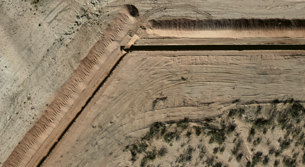
During construction of any large project, from a single location such as a plant or development to wide-ranging jobs such as pipelines or other energy transmission systems, it's vital for managers to understand progress and issues. Getting regular reports from various project managers is vital—but it's fragmented. And it's through their eyes, which often is a narrow slice of the pie. Aerial construction site monitoring gives you an unbiased, bird's eye view of your project at a given point in time.
The Benefits of Aerial Construction Site Monitoring
Aerial, on-demand construction site monitoring is gaining acceptance for many reasons:
-
- The ability to see the entire picture in one view
- The ability to zoom closer on areas of interest
- Getting objective information
- Tracking distant projects from home or office
- The ability to overlay progressive photos to visualize progress
- Options for monitoring nearby development in addition to company projects
- Information on demand at regular intervals
- The ability to track volumes of earth moved
Sometimes changes in location or dimensions are necessary on one side of a project—but that can necessitate updates elsewhere. Seeing the big picture informs everyone of changes needed as the project goes forward. It also allows managers to make sure every aspect is progressing at the same rate, or to make adjustments if they are not.
It's All In The Details
Need to see details? Prius Intelli can gather data with resolutions from 15 cm to 2.5 cm—close enough to count railroad ties. You choose what you need to see.
Individual reports are certainly valuable but sometimes are adjusted to an individual's understanding or their ground-based point of view. Aerial photography gives another perspective, which can either verify or update an individual's notes.
Today, upper management can have construction across state lines, time zones or continents. Aerial photography from Prius Intelli lets management see what they couldn't see, as if they were right on the spot.
With aerial photography you can look back and see incremental progress after the fact, providing diagnostic options as the project moves forward.
No project is constructed in a void. Especially with pipelines or utility lines, nearby developments such as new roads or buildings can affect construction—and aerial photography is the best way to quickly identify these changes.
How often do you need data? Weekly intervals are common but longer or shorter options are available. On-demand, as you need it, Prius Intelli can provide.
Tracking volumes of earth moved is one way to gauge progress of a site—and it provides necessary information for transport and disposal of residue. It can also inform of changes in drainage patterns.
GIS data can accurately locate any feature needed. We can supply your information in any format you need, whether you have GIS software or something else.
All this is just a start—there is much more information available through on-demand, custom-designed aerial photography.
Are you getting the big picture of how aerial data from Prius Intelli can give you the—big picture of construction sites? Ready to learn how cost-effective it can be to get information that could save you thousands by heading off problems before they start? Click here to get a cost estimate, or email us to learn more.
Follow Prius Intelli on LinkedIn.

