


Everyday Imagery by PI®
“We put the imagery of our Permian Basin assets to use every day across our full operations. It delivers detailed, usable answers for problem-solving and smarter planning… basically anywhere dirt gets pushed.”
John Evans, Land
Point EP, Fort Worth, Texas
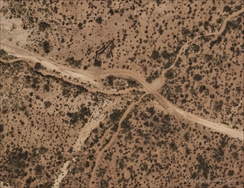
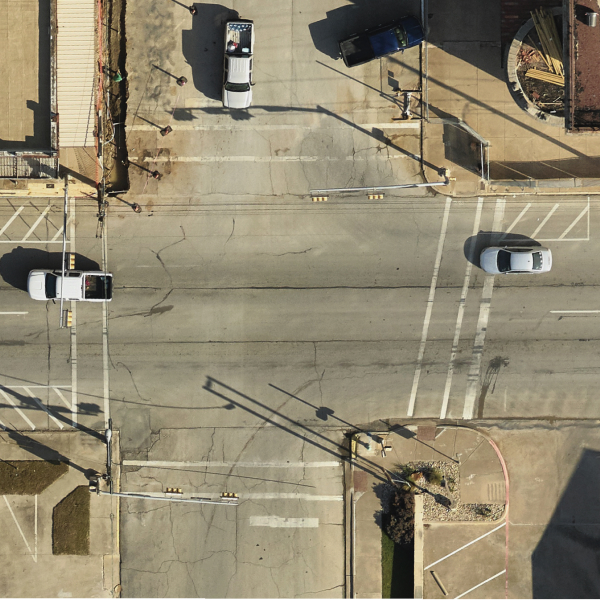
Gain a clear competitive edge with Prius Intelli’s aerial orthophotography for everyday use. Captured by fixed-wing aircraft at 10 cm (4”) resolution, Everyday Imagery by PI® is geometrically corrected to remove distortions, creating a precise basemap that allows highly accurate measurements. It’s a powerful visual tool that every department can use to save time and money – zero GIS technical experience required.
Plan and operate smarter. | Avoid budget pitfalls. | Get wells into production faster.
Plan and operate smarter.
Avoid budget pitfalls.
Get wells into production faster.
Here are just 12 operational efficiencies Everyday Imagery by PI® delivers.

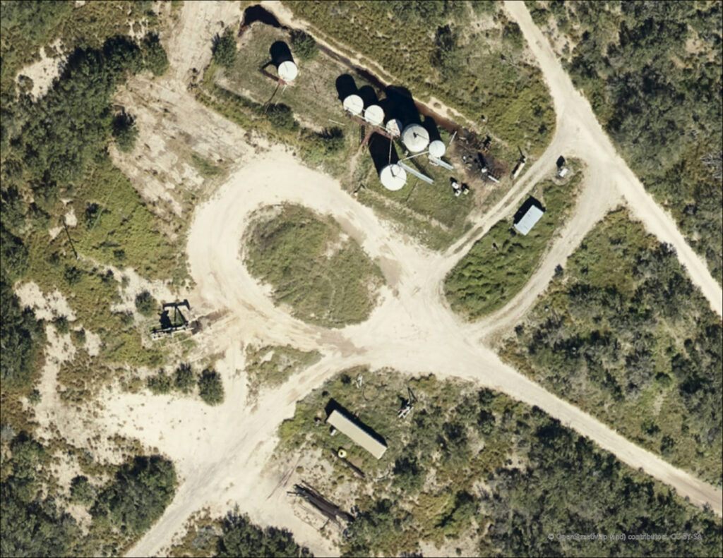
Inspect equipment and locations prior to acquisition. Identify trouble spots like poor road conditions or where the current operator has poured dirt to cover up old spills.

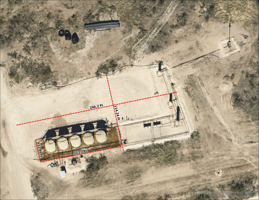
Identify optimal pad locations. Assess entry/exit options, measure exact distance to existing infrastructure, and sidestep regulatory concerns with smarter pad placement away from problematic areas.

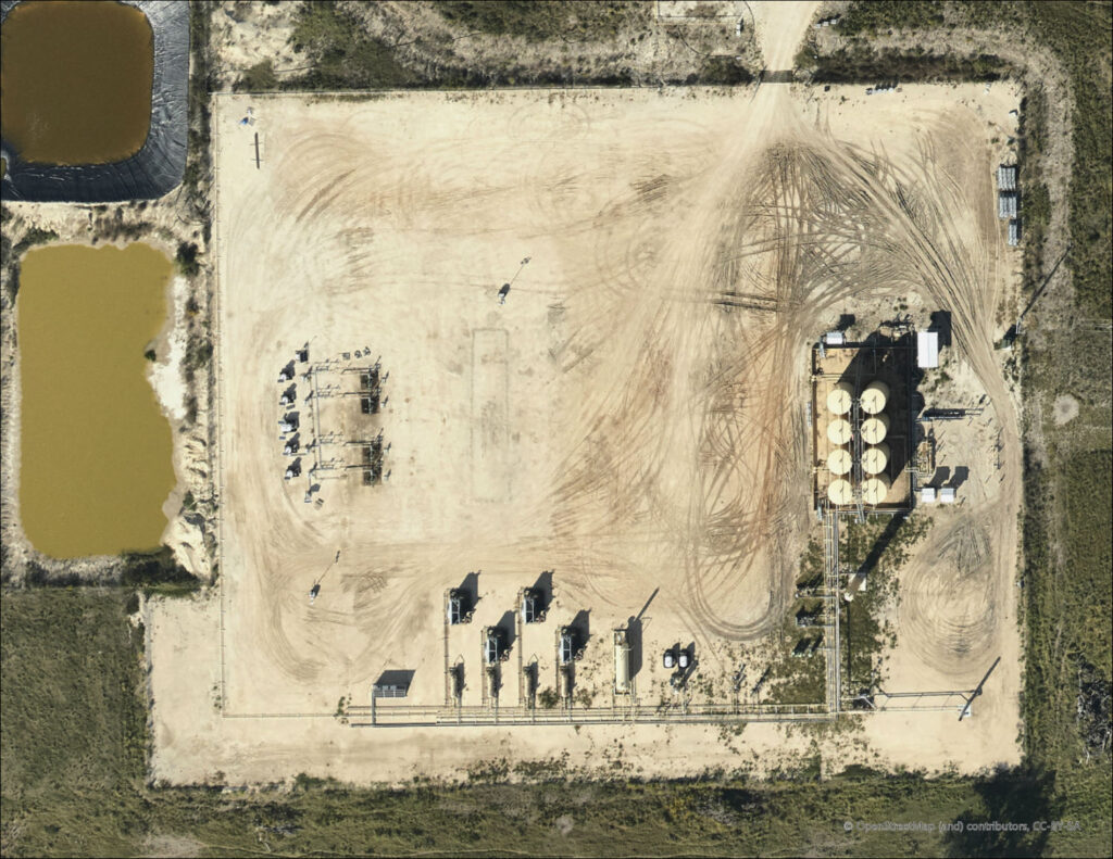
Plan entire multi-acre pad sites to streamline access, set-up, and operations, especially on complex projects undergoing simultaneous completions and workovers.

Get quotes faster by providing vendors site surveys overlaid on actual imagery so they know precisely what to bid on.

Avoid delays and costly change orders with more accurate service estimates by providing vendors site surveys overlaid on actual imagery so they know precisely what to bid on.

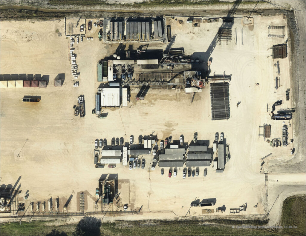
Minimize vendor-related set-up chaos for quicker equipment deployment on site.
“I was able to sketch out the infrastructure for 70 future wells with my Ops team from the comfort of my office.”
John Evans, Land | Point EP, Fort Worth, Texas

Calculate exactly how much road base is needed if new roads are required or if an existing road needs repair.

Pinpoint fence-related expenses by knowing the quantity and type of fences that must be removed and repaired for projects crossing multiple tracts of land.

Reduce the need for survey crews by monitoring potential encroachment from the comfort of your desktop using our aerial orthophotography.

Answer accounting questions fast with easily accessible visuals showing where capital purchases like pumpjacks and pipe have been deployed.

View individual wellheads and trace an entire spill line to ensure proper mitigation.

Provide regulatory agencies visual proof of mitigation to get them more comfortable with a spill response.
Here’s how to get started.
1. Submit a boundary outline of your AOI and approve your custom quote.
2. We deliver your imagery within 2-4 weeks, weather dependent.
3. Put your Everyday Imagery® to work and start saving time and money.
Timed Interval Flyovers are available, helping to ensure up-to-date data is available to better monitor your ever-changing operations.
Talk to our sales team about pricing packages.

Aerial Orthophotography FAQs
What is the horizontal accuracy of the imagery?
The aerial orthophotography imagery is ground-accurate to about 12”, so your basemap will align with any internal geospatial data that you have for your area.
If this is for basemaps, are large areas required? What’s the minimum size order?
We do not have any minimum size requirements, so we can collect 1 square mile, or we can collect 1,000s of square miles. The imagery is truly flown “on demand,” collecting exactly what you need.
Are ground control points or boots-on-the-ground required to get the data?
No, we do not need ground control, so you do not have to dispatch a ground crew to help collect the data. You also do not have to process the imagery in-house. We handle everything from start to finish.
Can I schedule subsequent flights or get the data refreshed on a scheduled basis?
Yes, absolutely. We can schedule refreshing of the imagery at whatever interval you’d want. Talk to our sales team about pricing packages.
Will this data provide me with enough clarity to see all objects I need to?
Yes, at 10 cm (4”) resolution, you will be able to see objects as small as fences, telephone poles, flowlines, and even pipe casing.
How recent is the photography?
Everyday Imagery by PI® is collected on demand specifically for your project area, so the data will be as recent as a couple of weeks from the time you place your order.

