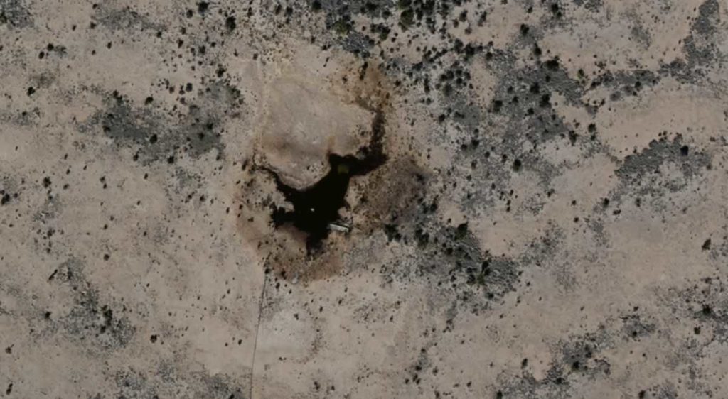
Ecological Remediation Accelerated Using GIS Services
After an ecological event, you need to remediate the area and limit the encroachment on the ecology. Learn how aerial imagery can help.

After an ecological event, you need to remediate the area and limit the encroachment on the ecology. Learn how aerial imagery can help.
How does a company effectively evaluate things without enough boots on the ground? Learn how on-demand aerial imagery changes the game.
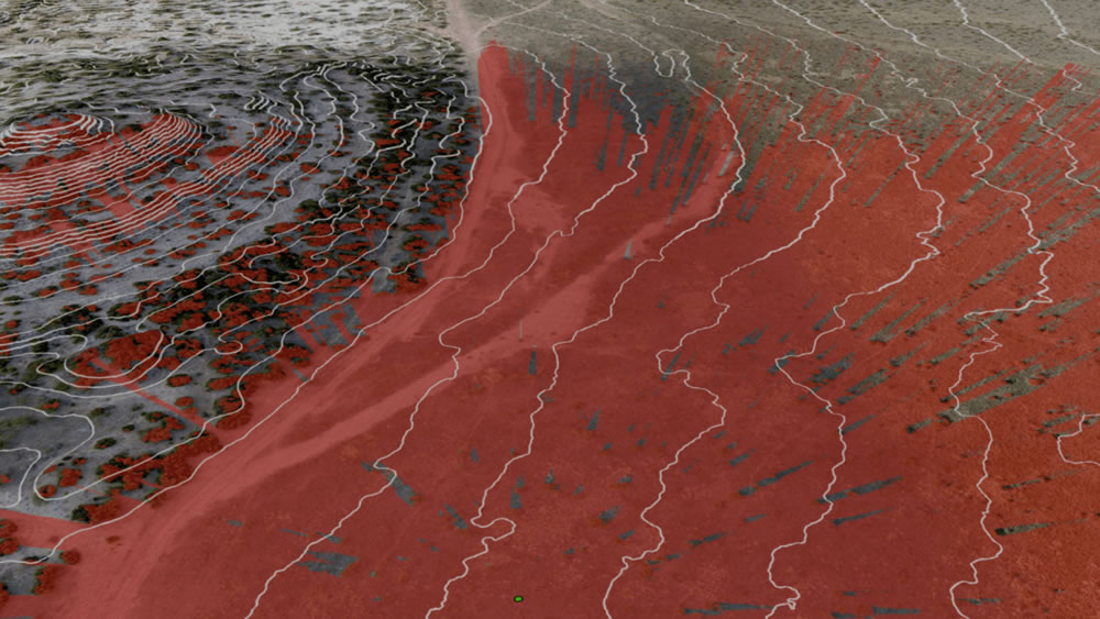
Geospatial data modeling is continuing to play an essential role in establishing accurate models of reality for a wide variety of projects. The application of geospatial intelligence has and will continue to impact businesses, such as engineering, oil and gas, real estate, and more, through the implementation of more detailed and valuable models. Proper modeling allows geospatial …
How Geospatial Data Modeling Sheds Light on Reality Read More »